Browse Listings in America
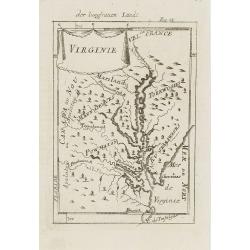
Virginie.
Charming miniature map of the Chesapeake Bay region locating the colony at Jamestown and the village of Pomejok.Several Indian tribes named including Powhatan. Title in c...
Date: Frankfurt, 1684
Selling price: ????
Please login to see price!
Sold in 2008
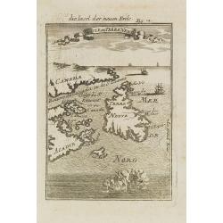
Isle de Terre Neuve.
Charming map centered on the island of Newfoundland, covering also the land around the St. Lawrence Gulf. Embellished with 6 sailing ships and hills in the Labrador area....
Date: Frankfurt, 1684
Selling price: ????
Please login to see price!
Sold in 2008
Amerique Septentrionale.
A charming late 17th-century French map of North America, showing California to 40 degrees North and labeled I.Calfornie.From the German text edition published by Davis Z...
Date: Frankfurt, 1684
Selling price: ????
Please login to see price!
Sold in 2008
Isles Açores.
Charming map of the Azores islands shown in a perspective view of the Atlantic ocean and embellished with fighting ships just off shores.From the French text edition of D...
Date: Frankfurt, 1684
Selling price: ????
Please login to see price!
Sold in 2008
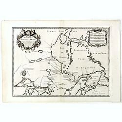
Canada ou Nouvelle France.
A strange early depiction of the Eastern Seaboard, from Terres Arctiques Incognues to Virginie, including also an outline of the Great Lakes. Native Indians appear at the...
Date: Frankfurt, 1684
Selling price: ????
Please login to see price!
Sold in 2008
Havana.
Handsome view of the Havana harbour, assaulted by several vessels. Title garland on top.From the French text edition of Description d'Univers, 1683. by Allain Manneson Ma...
Date: Frankfurt, 1684
Selling price: ????
Please login to see price!
Sold in 2008
Floride. / Das Landt Florida.
A charming late 17th century French map of Florida, Virginia, Louisiana. Tegesta is the name given to the Florida peninsula.The map has little detail, Virginia is above t...
Date: Frankfurt, 1684
Selling price: ????
Please login to see price!
Sold in 2008
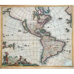
Nouveau Continent ou Amerique.
Attractive map of the western hemisphere showing the American continent and large part of the Pacific ocean. It outlines the coasts of Australia and Antarctica according ...
Date: Frankfurt, 1684
Selling price: ????
Please login to see price!
Sold in 2008
Nouveau Mexique et Californie.
A charming late 17th century French map of California, Nueva Granada and Nouvelle Espagne. California with flat northern coast, labeled Isle de Calfornie. A unique projec...
Date: Frankfurt, 1684
Selling price: ????
Please login to see price!
Sold in 2008
I.d'Hispaniola et Pto Rico.
Map showing the islands of St. Domingo and Puerto Rico. The map is inserted in a prospective view of the Caribbean Sea, where some vessels are involved in a naval combat....
Date: Frankfurt, 1684
Selling price: ????
Please login to see price!
Sold in 2008
I.de Cuba et de Jamaica.
Map showing the islands of Cuba and Jamaica. The map is inserted in a prospective view of the Caribbean Sea, where some vessels are involved in a naval combat.From the Fr...
Date: Frankfurt, 1684
Selling price: ????
Please login to see price!
Sold in 2008
Virginie.
Charming miniature map of the Chesapeake Bay region locating the colony at Jamestown and the village of Pomejok.Several Indian tribes named including Powhatan. Title in c...
Date: Frankfurt, 1684
Selling price: ????
Please login to see price!
Sold in 2008
Nouveau Mexique et Californie.
A charming late 17th century French map of California, Nueva Granada and Nouvelle Espagne. California with flat northern coast, labeled Isle de Calfornie. A unique projec...
Date: Frankfurt, 1684
Selling price: ????
Please login to see price!
Sold in 2008
Havana.
Handsome of Havana and its harbour, assaulted by several vessels. Title garland on top.From the French text edition of Description d'Univers, 1683. by Allain Manneson Ma...
Date: Frankfurt, 1684
Selling price: ????
Please login to see price!
Sold
Isles Açores.
Charming map of the Azores islands shown in a perspective view of the Atlantic ocean and embellished with fighting ships just off shores.From the French text edition of D...
Date: Frankfurt, 1684
Selling price: ????
Please login to see price!
Sold in 2013
Novi Belgii Novaeque Angliae nec non partis Virginiae tabula : multis in locis emendata / per Nicolaum Visscher.
An essential map of the New Netherlands, New England, Pennsylvania, and parts of Maryland and Virginia. Although the map itself is primarily derived from Joannes Janssoni...
Date: Amsterdam, 1684
Selling price: ????
Please login to see price!
Sold in 2014
A Description of The South Sea & Coasts of America Containing ye whole Navigation and all those places at which Capt. Sharp and his Companions were in the years 1680 &1681
Very rare map of South America only published in one edition of Exquemelin's famous account: Bucaniers of America! The rare books which contain this map are currently off...
Date: London, 1684
Selling price: ????
Please login to see price!
Sold in 2014
Mexique. [die Stadt Mexica]
An attractive copper engraving, depicting a bird's-eye view of Mexico City.From the German text edition of Description d'Univers, published in 1684 by Allain Manneson Mal...
Date: Paris, 1684
Selling price: ????
Please login to see price!
Sold in 2018
Partie de la Nouvelle France. . .
FIRST EDITION: 1685 map with the Southwest coast of the Hudson's Bay from Port Nelson to Albany (Anglois') was well known from fir trading but further north was mere conj...
Date: Paris, 1685
Selling price: ????
Please login to see price!
Sold in 2019
Amerique Septentrionale.
Alain Manneson Mallet (1603-1706) published in 1683 his ' Description de l' Univers' in 5 volumes. In 1686 a German edition appeared.Allain Mallet's attractive little map...
Date: Frankfurt, 1686
Selling price: ????
Please login to see price!
Sold in 2008
Carte de l'Isthme de Panama. . .
This very attractive map of the Isthmus of Panama was engraved for an early French edition of Alexandre Olivier Exquemelin's History of the Bucaniers of America, an inter...
Date: [Paris], 1686
Selling price: ????
Please login to see price!
Sold in 2019
L'America Settentrionale..
Second edition of Rossi's map of North America, based upon Sanson's seminal map, but with revised Italian nomenclature. From Rossi's Mercurio Geographico..Includes a deta...
Date: Rome 1687
Selling price: ????
Please login to see price!
Sold
L'America Meridionale..
Second edition of Rossi's map of South America, based upon Sanson's map, but with revised Italian nomenclature. From Rossi's Mercurio Geographico..Engraved by Giorgio Wid...
Date: Rome 1687
Selling price: ????
Please login to see price!
Sold
L'America Settentrionale. Nuovamente Corretta et Accresciuta Secondo le Relationi Piu Moderne da Guglielmo Sansone Geografo ...
Second edition of Rossi's map of North America, based upon Sanson's seminal map, but with revised Italian nomenclature. From Rossi's Mercurio Geographico..Includes a deta...
Date: Rome, 1687
Selling price: ????
Please login to see price!
Sold in 2012
Americae nova discriptio.
A map of America that was never included in an atlas and of which only five other copies are known to exist. The map has original colors although the colors have faded a ...
Date: Amsterdam, 1687
Selling price: ????
Please login to see price!
Sold in 2019
Partie Occidentale du Canada ou de la Nouvelle France...
A very rare map of the Great Lakes by Coronelli / Nolin and one of the most beautiful, acquirable works to focus on the region. As Tooley states, ?it was the best represe...
Date: Paris, 1688
Selling price: ????
Please login to see price!
Sold
[ America]
Charming wood block map of America by the Italian XVIth and XVIIth century writer, humanist and cartographer Giuseppe Rosaccio. Taken from "Teatro del mondo e sue pa...
Date: Bologna, 1594 - 1688
Selling price: ????
Please login to see price!
Sold in 2014
L'America meridionale...
Rossi's map of South America, based upon Sanson's map, but with revised Italian nomenclature. Showing the mythical Lag. Di Parime, with Manoa Dorado (city of gold) on its...
Date: Rome, 1677-1688
Selling price: ????
Please login to see price!
Sold in 2015
[Globe gore, part of Baja California Sur and Mexico.]
Gore segment from his 110 centimeters in diameter globe of 1688 with southern tip of Baja California Sur . Some of the half-gores were reprinted in the 1696-97 edition of...
Date: Venise, 1688
Selling price: ????
Please login to see price!
Sold in 2020
Nouvelle Carte de la CAROLINE.
A scarce small map of Carolina by the English cartographer Robert Morden. Scarce early edition of Abraham Wofgang's Amsterdam edition of Morden's map of the Carolina, one...
Date: Amsterdam, 1688
Selling price: ????
Please login to see price!
Sold in 2020
Nouvelle Carte de la Pensylvanie Maryland Virginia et Nouvelle Jarsey.
A scarce edition of this early map of the east coast region centered on New York and the Chesapeake and Delaware, from Abraham Wolfgang's L'Amerique Angloise, ou Descript...
Date: Amsterdam, 1688
Selling price: ????
Please login to see price!
Sold in 2020
Castilla del Or Guiana Peru The Country of the Amazones.
A delightful small map of Peru and northern most portion of South America, into what is now north western Brazil. Showing and naming many of the large number of rivers th...
Date: London, 1688
Selling price: ????
Please login to see price!
Sold in 2020
De kust der Zuyd zee.. [4 maps]
Four sheets covering the coasts from Southern Mexico until Chilli. Each maps is clearly engraved and belongs to an text page as each map has a page reference.Rare.
Date: Amsterdam c.1690
Selling price: ????
Please login to see price!
Sold
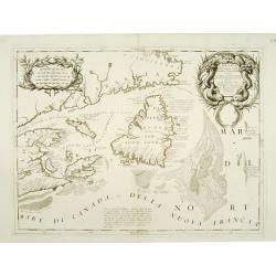
Canada Orientale nell\' America Settentrionale ..
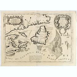
Elaborate map of the Newfoundland, Labrador, Nova Scotia and the Gulf of St. Lawrence. Two ornate cartouches. From Coronelli\'s rare Atlante Veneto, one of the most decor...
Date: Venice 1690
Selling price: ????
Please login to see price!
Sold in 2008
ISOLE AZZORI, O AZZORIDI...
This handsome, elaborate map of the Azores includes a detailed bird's-eye plan of Angra enclosed in an ornate, drape-style cartouche. Coastal towns are named. The beautif...
Date: Venice, c. 1690
Selling price: ????
Please login to see price!
Sold
Canada Orientale nell' America Settentrionale ..
Elaborate map of the Newfoundland, Labrador, Nova Scotia and the Gulf of St. Lawrence. Two ornate cartouches. From Coronelli's rare Atlante Veneto, one of the most decora...
Date: Venice 1690
Selling price: ????
Please login to see price!
Sold
Mare del Nord.
Shows the Atlantic Ocean between Iceland, Europe, West-Africa, Brazil and Canada, including the Caribbean. Here Coronelli splendidly delineates the center of European eco...
Date: Venice 1690
Selling price: ????
Please login to see price!
Sold
[4 sheets] America Settentrionale Colle Nuove Scoperte Sin All Anno 1688
Gorgeous example of Coronelli's famous four- sheet map of America. One of the best examples of California as an island. The map also includes extensive annotations on the...
Date: Venice 1690
Selling price: ????
Please login to see price!
Sold
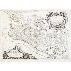
Parte della Nuova Spagna, o del Mexico dove sono le Provincie di Guadalaira Xalisco Mecoacan e Mexico..
A beautiful map depicting western Mexico covering the area along the Pacific Coast from Xiamora to Acapulco, with a vivid portrayal of the volcano of Popocatepec. With im...
Date: Venice 1690
Selling price: ????
Please login to see price!
Sold
Isole Azzori, o Azzoridi dette altrimenti Acipitrum, Tertiae, Flandricae, et Superiores..
A beautiful and highly decorative map of the Azores Islands. With large title cartouche in the upper right corner decorated with coral, fish, seaweeds and pearl chains.In...
Date: Venice 1690
Selling price: ????
Please login to see price!
Sold
Corso del Fiume dell Amazoni..
An uncommon map of the northern half of the continent focusing on the course of the Amazon River.Typical of Coronelli's strong engraving style the topographical features ...
Date: Venice 1690
Selling price: ????
Please login to see price!
Sold
Isola de Iames, o Giamaica..
Map of Jamaica by the remarkable Vincenzo Coronelli, (1650-1718), a Franciscan Friar and appointed General of the Order in 1701.He was cosmographer to the Republic of Ven...
Date: Venice 1690
Selling price: ????
Please login to see price!
Sold
La Lovisiana, Parte Settentrionalle, Scoperta sotto la Protettione di Luigi XIV, Rè di Francia..
One of the most important maps of the Great Lakes and Upper Mississippi, based upon reports of La Salle, Hennepin, Marquette, Jolliet and other French Jesuits who were ac...
Date: Venice 1690
Selling price: ????
Please login to see price!
Sold
Nieu Amsterdam al. New York.
Engraved by Aldert Meyer for Carolus Allard's for his Orbis habitabilis oppida et vestitus the print shows two locals and a distance view of lower Manhattan. This rare wo...
Date: Amsterdam, c.1685-1690
Selling price: ????
Please login to see price!
Sold in 2010
Nieu Amsterdam al. New York.
Engraved by Thomas Doesburgh (active between 1683 and 1714) for Carolus Allard's for his Orbis habitabilis oppida et vestitus the print shows a distance view of lower Man...
Date: Amsterdam, c.1685-1690
Selling price: ????
Please login to see price!
Sold in 2011
Isola di Capo Breton./ Isola e citta di cartagena Nell America.
An engraving of Cape Breton, from Isolario Dell'Atlante Vento.On verso a map of Cartagena (220x125mm.)More about Coronelli. [+]
Date: Venice, 1690
Selling price: ????
Please login to see price!
Sold in 2011
A New Map of South America Showing its General Divisions Chief Cities & Towns: Rivers, Mountains dedicated to his highness William Duke of Gloucester
Striking map of South America showing mainly large rivers and lakes but with notes about discovery, has A very large elaborate title cartouche and colored by regions. Thi...
Date: Oxford, 1690
Selling price: ????
Please login to see price!
Sold in 2011
America Settentrionale Colle Nuove Scoperte Sin All Anno 1688. . . (together with] America meridionale . . .
Gorgeous example of Coronelli's famous four- sheet map of America. One of the best examples of California as an island. The map also includes extensive annotations on the...
Date: Venice, 1690
Selling price: ????
Please login to see price!
Sold in 2011
America meridionale . . .
Gorgeous example of Coronelli's famous map of South America. The outline of South America is well charted and every port and bay has been identified and named in detail. ...
Date: Venice, 1690
Selling price: ????
Please login to see price!
Sold in 2017
Isola di Capo Breton./ Isola e citta di cartagena Nell America.
An engraving of Cape Breton, from Isolario Dell'Atlante Vento.On verso a map of Cartagena (220x125mm.)
Date: Venice, 1690
Selling price: ????
Please login to see price!
Sold in 2018
Insulae Flandricae olim Asores dictae.
Old map of the Azores, Including the island of Terceira. It was at the time an important port and administrative center of the island group. It is today the site of a U.S...
Date: Amsterdam, 1690
Selling price: ????
Please login to see price!
Sold in 2014
Canada Orientale nell' America Settentrionale . . .
Elaborate map of the Newfoundland and the mouth of the St. Lawrence, showing Nova Scotia, Cape Breton, Isle de Anticosti and Prince Edward Island.Two ornate cartouches. F...
Date: Venice, 1690
Selling price: ????
Please login to see price!
Sold in 2012
Recentissima Novi Orbis Sive Americae Septentrionalis et Meridionalis Tabula. . .
First state of Danckerts map of the Americas. California depicted as an Island, mostly based on Sanson second projection. The Great Lakes (also based on Sanson) and early...
Date: Amsterdam, 1690
Selling price: ????
Please login to see price!
Sold in 2012
Mare del Nord.
Shows the Atlantic Ocean between Iceland, Europe, West-Africa, Brazil and Canada, including the Caribbean. Here Coronelli splendidly delineates the center of European eco...
Date: Venice, 1690
Selling price: ????
Please login to see price!
Sold in 2013
Novissima et Accuratissima Totius Americae.
An uncommon and elegant Dutch map of the Americas.
Date: Amsterdam, c.1690
Selling price: ????
Please login to see price!
Sold in 2014
Canada Orientale nell' America Settentrionale ..
Elaborate map of the Newfoundland, Labrador, Nova Scotia and the Gulf of St. Lawrence. Two ornate cartouches. From Coronelli's rare Atlante Veneto, one of the most decora...
Date: Venice, 1690
Selling price: ????
Please login to see price!
Sold in 2015
America Settentrionale Colle Nuove Scoperte Sin All Anno 1688. . . (together with] America meridionale . . .
Gorgeous example of Coronelli's famous four- sheet map of America. One of the best examples of California as an island. The map also includes extensive annotations on the...
Date: Venice, 1690
Selling price: ????
Please login to see price!
Sold in 2018
Isola de Iames, o Giamaica. . .
A decorative map of Jamaica with many details, bays, islands, and shows all the islands different parishes.
Date: Venice, ca. 1690
Selling price: ????
Please login to see price!
Sold in 2017
Isola di Maria Galante nell Antilli. . .
One of the few separate maps of the island of Marie Galante, showing sugar plantations, and (curiously) some large trees. Fort Moliere is shown in a small inset. Small pe...
Date: Venice, ca. 1690
Selling price: ????
Please login to see price!
Sold in 2018
Cuba Insula [on sheet with] Hispaniola Insula [and] Ins. Iamaica [and] Ins. S. Ioannis [and] I.S. Margareta.
A fine map of the important islands in the West Indies. This Cloppenburgh map features the islands, wonderful cartouches, distance scales, and several sailing ships decor...
Date: Amsterdam, 1690
Selling price: ????
Please login to see price!
Sold in 2020
Veroveringe van Rio Grande in Brasil. Anno 1633 Northern Brazil.
A bird's-eye view of the fort (present-day Natal) at the mouth of the Rio Potengi showing the Dutch invasion and capture of the Portuguese fort in 1633. The harbor is fil...
Date: Amsterdam, 1690
Selling price: ????
Please login to see price!
Sold in 2021
T'Neemen van de Suyker Prysen inde Bay de Tode los Santos Anno 1627.
A nice copper engraving illustrating the Dutch fleet capturing the fort at the entrance to the Baia de Todos os Santos, in northeastern Brazil. The WIC fleet that capture...
Date: Amsterdam, 1690
Selling price: ????
Please login to see price!
Sold in 2021
Povo [with] Villa d Olinda d Pernambuco.
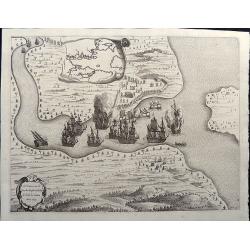
These splendid views encompass one of the earliest etchings of this region and its cities. Artistically engraved armies, fortresses, and ships. At top is a view of Pov...
Date: Amsterdam, 1690
Selling price: ????
Please login to see price!
Sold in 2021
Afbeeldinge vande Cabo St. Augustin met Haer Forten.
This fine bird's-eye view portrays the Dutch fleet and the fortresses at Cabo Santo Agostinho. The strapwork title cartouche incorporates a numbered key identifying four ...
Date: Amsterdam, 1690
Selling price: ????
Please login to see price!
Sold in 2021
Afbeeldinghe van Pariba ende Forten.
This bird's-eye map shows the region of Paraiba and Portuguese fortifications at the mouth of the River Paraiba. A very early view of this region with highly detailed and...
Date: Amsterdam, 1690
Selling price: ????
Please login to see price!
Sold in 2021
Mare del Nord.
This splendid maritime map shows the Atlantic Ocean between Iceland, Europe, West-Africa, northern Brazil and eastern Canada, including the Caribbean. Here Coronelli deli...
Date: Venice, 1690
Selling price: ????
Please login to see price!
Sold in 2020
The Magellanick Land.
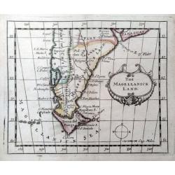
A rare miniature map of Patagonia from John Seller's 'A New Systeme of Geography'. With a compass and decorative title cartouche.
Date: London, 1690
Selling price: ????
Please login to see price!
Sold in 2020
South America.
A rare miniature map of South America from John Seller's 'A New Systeme of Geography'. With a decorative title cartouche.
Date: London, 1690
Selling price: ????
Please login to see price!
Sold in 2020
Amerique Meridionale..
From Jaillot's Atlas Nouveau. A very impressive large scale map: the large decorative title cartouche is balanced by an equally large cartouche around the scale bars, sur...
Date: Paris 1691
Selling price: ????
Please login to see price!
Sold
Amerique septentrionale.
Engraved by Cordier. Spectacular example of Jaillot's map of North America, showing California as an Island, based upon Sanson's landmark map of 1656. This map shows the ...
Date: Paris, 1692
Selling price: ????
Please login to see price!
Sold
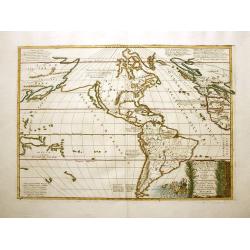
Amerique Septentrionale divisée en ses principales parties?
Impressive map of North America, prepared by Nicolas Sanson and published by Pierre Mortier in Amsterdam. The map is copied from Jaillot's map of 1674 and only some small...
Date: Amsterdam, 1692
Selling price: ????
Please login to see price!
Sold in 2008
L'Amerique meridionale divisée en ses principales parties ou sont distingués les vns des autres les estats suivant qu'ils appartiennent présentement aux François, Castillans, Portugais, Hollandois, &c
Very good impression of Jaillot's large map of South America. With additional title in top. The map include lines of latitude and longitude, some topographical details, l...
Date: Amsterdam, c.1692
Selling price: ????
Please login to see price!
Sold
Isola Cuba Descritta dal P. Mro Coronelli
This scarce, attractive map centers on Cuba, and also shows the lower Bahamas and the Cayman Islands. Most detail is confined to the coastlines. The map is decorative wit...
Date: Venice, 1692
Selling price: ????
Please login to see price!
Sold in 2012
L'Amérique Méridionale.
An interesting small map of South America by Nicolas de Fer. From his rare "Petit et Nouveau Atlas". The first edition was published in 1697 and was republished...
Date: Paris, 1692
Selling price: ????
Please login to see price!
Sold in 2018
The Island of California.
A rare miniature map focusing on the large Island of California, in original outline color. An example of the first state. Inaccurately and extensively detailed with moun...
Date: Ulm, 1692
Selling price: ????
Please login to see price!
Sold in 2017
[Florida]
A rare regional American map, published by Johann Ulrich Muller. A highly coveted and most collectable miniature map of Florida, the Gulf Coast, Texas, the Mississippi Va...
Date: Ulm, 1692
Selling price: ????
Please login to see price!
Sold in 2017
[Neu Mexico]
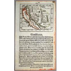
A rare miniature map of California and Nova Mexico, published by Johann Ulrich Muller in Ulm .This attractive map shows the island of California and the contiguous parts ...
Date: Ulm, 1692
Selling price: ????
Please login to see price!
Sold in 2018
[Neu Mexico]
A rare miniature map of California and Nova Mexico, published by Johann Ulrich Muller in Ulm .This attractive map shows the island of California and the contiguous parts ...
Date: Ulm, 1692
Selling price: ????
Please login to see price!
Sold in 2020
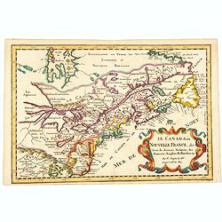
Le Canada, ou Nouvelle France, &c, tiree de diverses Relations des Francois, Anglois, Hollandois, &c. . .
A fine smaller map of the north eastern US seaboard, extending to the Great Lakes (shown as open-ended) and beyond into 'Upper Canada' by Nicolas Sanson, and originally f...
Date: Utrecht, 1692
Selling price: ????
Please login to see price!
Sold in 2021
Atlantis Insula a Nicolao Sanson Antiquitati Restituta..
This is Sanson's unusual composition showing ancient geography within a contemporary outline of the Americas, which is noted in the cartouche as the mythical island of At...
Date: Padua, 1694
Selling price: ????
Please login to see price!
Sold in 2012


![Mexique. [die Stadt Mexica]](/uploads/cache/42156-250x250.jpg)


![[ America]](/uploads/cache/30316-250x250.jpg)

![[Globe gore, part of Baja California Sur and Mexico.]](/uploads/cache/45452-250x250.jpg)


![De kust der Zuyd zee.. [4 maps]](/uploads/cache/15730-250x250.jpg)


![[4 sheets] America Settentrionale Colle Nuove Scoperte Sin All Anno 1688](/uploads/cache/23437-250x250.jpg)


![America Settentrionale Colle Nuove Scoperte Sin All Anno 1688. . . (together with] America meridionale . . .](/uploads/cache/31293-250x250.jpg)




![America Settentrionale Colle Nuove Scoperte Sin All Anno 1688. . . (together with] America meridionale . . .](/uploads/cache/40673-250x250.jpg)


![Cuba Insula [on sheet with] Hispaniola Insula [and] Ins. Iamaica [and] Ins. S. Ioannis [and] I.S. Margareta.](/uploads/cache/82456-250x250.jpg)

![Povo [with] Villa d Olinda d Pernambuco.](/uploads/cache/82460-250x250.jpg)




![[Florida]](/uploads/cache/40498-250x250.jpg)
![[Neu Mexico]](/uploads/cache/40499-250x250.jpg)
![[Neu Mexico]](/uploads/cache/43923-250x250.jpg)
