Browse Listings in Africa
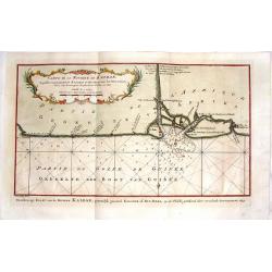
Carte de la Riviere de Kalbar.
Detailed coastal map of the Guinea coast of West Africa based on the 1699 voyage of James Barbot and John Grazilhier to the Kalabar River. This was the heart of the slave...
Date: Amsterdam, 1770
Selling price: ????
Please login to see price!
Sold in 2015
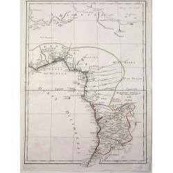
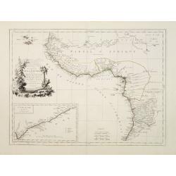
Guinee Guinee IIe. Feuille.
An example of Bonne's 1770 decorative map of West Africa. It covers from the Gold Coast (Ghana), south around the Bight of Benin (Biafara) to Gabon, Congo and Angola. It...
Date: Paris, 1770
Selling price: ????
Please login to see price!
Sold in 2022
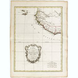
Carte de la Guinee, contenant les Isles du Cap Verd, le Senegal, la Cote de Guinee proprement dite, les Royaumes de Loango, Congo, Angola et Benguela....
A map of the Gulf of Guinea by Jean Lattré, a Paris-based engraver and publisher. He worked with Robert de Vaugondy, J. Janvier and R. Bonne. From his "Atlas Modern...
Date: Paris, 1771
Selling price: ????
Please login to see price!
Sold in 2017
Partie de la Cote Orientale d'Afrique.
A striking 18th Century map of the east coast of Africa, Madagascar, Mauritius and Reunion Island. The map is divided into kingdoms and shows nice detail. Rigobert Bonne ...
Date: Paris, 1772
Selling price: ????
Please login to see price!
Sold in 2020
Carte des Isles Canaries dressee sur les Journaux des navigateurs. . .
Uncommon edition of this fine map of the Canaries.In lower right engraved "3."From Atlas Portatif pour servir a l'intelligence de l'Histoire Philosophique et Po...
Date: Amsterdam, 1773
Selling price: ????
Please login to see price!
Sold in 2012
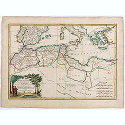
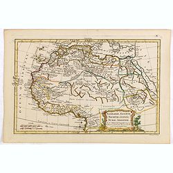
Barbarie, Egypte, Nigritie, Guinée, Nubie, Abassinie. . .
The map has been engraved by E. Dussy and the map is after Robert de Vaugondy. Embellished with a decorative title cartouche.
Date: Paris, ca. 1773
Selling price: ????
Please login to see price!
Sold in 2015
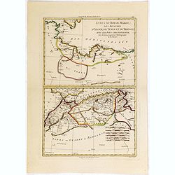
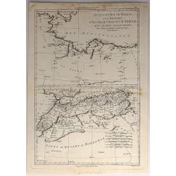
Etats du Roi de Maroc. .
The map has been engraved by André and the map is after Rigobert Bonne (1727–1795) who was one of the most important cartographers of the late 18th century.
Date: Paris, ca. 1773
Selling price: ????
Please login to see price!
Sold in 2015
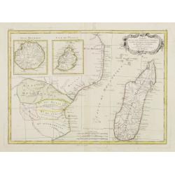
LE CANAL DE MOSAMBIQUE, L'ISLE DE MADAGASCAR, LES ETATS DU MONOMOTAPA ET LES ROYAUMES VOISINS
Detailed french map, by Bonne (Ingénieur-Hydrographique de la Marine de France) engraved by André. Many place-names and topographical detail on Madagascar, I. de Bourbo...
Date: Paris c. 1774
Selling price: ????
Please login to see price!
Sold
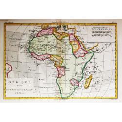
Afrique.
Rigobert Bonne (1727-1795), French cartographer. His maps are found in a.o. Atlas Moderne (1762), Raynal's Histoire Philos. du Commerce des Indes (1774) and Atlas Encyclo...
Date: Paris, 1774
Selling price: ????
Please login to see price!
Sold
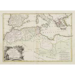
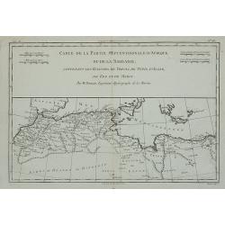
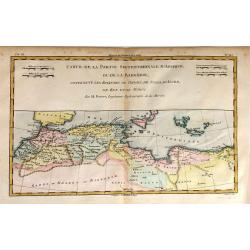
Carte de la Partie Septentrionale d'Afrique ou de la Barbarie, ...
A map showing Africa's Mediterranean coast.Rigobert Bonne (1727-1795), French cartographer. His maps are found in Atlas Moderne (1762), Raynal's Histoire Philos. du Comme...
Date: Paris, 1774
Selling price: ????
Please login to see price!
Sold in 2012
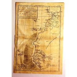
Partie Occidentale de L'Ancien Continent depuis Lisbonne Jusqu'a la Riviere de Sierra Leona.
Fine copper engraved map featuring the west coast of northern Africa and the Madiera, Canary and Cape Verde Island groups. Engraved by Dien for R. Bonne's "RAYNAL'S ...
Date: Paris, 1774
Selling price: ????
Please login to see price!
Sold in 2016
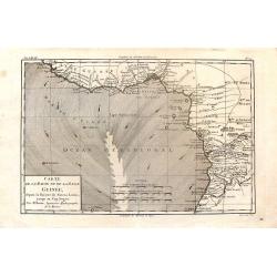
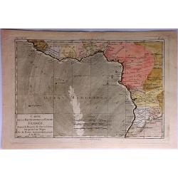
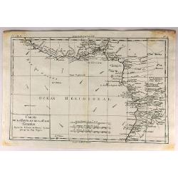
Carte de la Haute et de la Basse Guinee.
Fine copper engraved map featuring the west coast of northern Africa from The Sierra Leone River to Cape Negro. Engraved by Dien for R. Bonne's "RAYNAL'S HISTOIRE PH...
Date: Paris, 1774
Selling price: ????
Please login to see price!
Sold in 2016
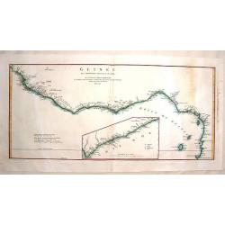
Guinee Entre Serre-Lione et le Passage de la Ligne.
Copper engraved map of the coast of the West African country of Guinee between Serre-Leone and the Equator. This was one of the top sources of slaves during the Historica...
Date: Paris, 1775
Selling price: ????
Please login to see price!
Sold in 2014
Carte de la Cote orientale de Madagascar, depuis la Pointe de l'Est jusques et compris le Lac Nossé Bé.
Large colored sea of Madagascar. Showing the northeast coastline of Madagascar and four inset maps of the harbours and anchorage of Tamatave, Foulpointe, Teintingue und ...
Date: Paris, 1775
Selling price: ????
Please login to see price!
Sold in 2015
Carte de la Cote orientale de Madagascar depuis Mananzari jusques et compris l'anse du Fort Dauphin.
Large colored sea of Madagascar. Showing the southeast coastline of Madagascar and two inset maps of the harbours and anchorage of Tolanaro and the islands of Saite Luce...
Date: Paris, 1775
Selling price: ????
Please login to see price!
Sold in 2015
Cote Orientale de Madagascar Depuis la Riviere d'Ivondrou jusque Mananzari.
Finely colored sea of Madagascar. Showing the east coastline of Madagascar and two inset maps of the harbour and anchorage of Manourou and the River Mananzari titled Pla...
Date: Paris, 1775
Selling price: ????
Please login to see price!
Sold in 2015
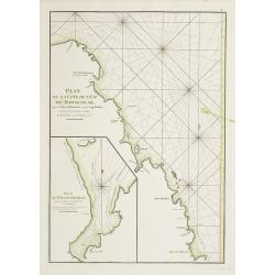
Plan de la Cote de L'Est de Madagascar, depuis la Baye de Vohemare jusqu'au Cap d'Ambre
Original colored sea of Madagascar. Showing the east coastline of Madagascar and one inset map titled Plan du Port de Louquez. From the second revised and enlarged editi...
Date: Paris, 1775
Selling price: ????
Please login to see price!
Sold in 2015
Plan de la Baye de St. Augustin en l'Isle de Madagascar / Plan du Port de l'Isle Ste. Marie.
Two finely colored plans of Madagascar on one sheet. Showing St. Augustin and the port of the island Ste. Marie at the east coast of Madagascar. From the second revised a...
Date: Paris, 1775
Selling price: ????
Please login to see price!
Sold in 2015
Côte de L'Isle Madagascar depuis la Baye de Vohemare jusqu'à la Pointe de l'Est.
Finely colored sea chart of Madagascar. Showing the east coastline of Madagascar and one inset maps of the Cap de l'Est titled Plan du Port et de la Baye du Cap de l'Est....
Date: Paris, 1775
Selling price: ????
Please login to see price!
Sold in 2015
Plan de l'Isle de Patte et de son Port / Plan des Isles Querimbo, Oybo et Matemo.
Two finely colored sea charts of the coast of Africa on one sheet. Showing several Islands at the coast of Kenya and Mozambique. From the second revised and enlarged edit...
Date: Paris, 1775
Selling price: ????
Please login to see price!
Sold in 2015
Carte réduite de l'Archipel du Nord-Est de l'Isle Madagascar depuis la lingne Equinoctiale jusqu'au 21d.30m. de Latitude Méridionale
Superb large original sea chart of the Indian Ocean by Mannevillette. Very detailed and large scale, showing the North of Madagascar with many place names, the Seychelle...
Date: Paris, 1775
Selling price: ????
Please login to see price!
Sold in 2011
Vue de la Baye de False / Vue de la Rade de Simons-Baye. Vue du Cap des Aiguilles. Vue du Cap des Hottentots. Vue du Cap de Bonne Espérance.
Three French of Cape of Good Hope. Each chart has in addition profiles and a lettered key.Latitude and longitude scales, compass rose and system of rhumb lines, sounding...
Date: Paris, ca. 1775
Selling price: ????
Please login to see price!
Sold in 2012
Plan du Cap de Bonne-Espérance et de ses Environs.
French of Cape of Good Hope.Latitude and longitude scales, compass rose and system of rhumb lines, soundings near coast and in bay areas.D' Après de Mannevillette (1707...
Date: Paris, ca. 1775
Selling price: ????
Please login to see price!
Sold in 2015
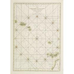
Carte des Isles Açores et des Isles Canaries, Dressée pour le Neptune Oriental
French of Canaries Islands and the Azores.Latitude and longitude scales, compass rose and system of rhumb lines, soundings near coast and in bay areas.D' Après de Manne...
Date: Paris, Brest, chez Demonville, 1775
Selling price: ????
Please login to see price!
Sold in 2012
Carte Réduite de l'Océan Orientale qui Contient la Côte d'Afrique, Avec l'Isle Madagascar et les Isles adjacentes.
French of South Africa with Cape Town and part of the south east coast . Insets of "Mossel Bay", "Plan de la rade st.Blaise" and "Plan de la Bay...
Date: Paris, Brest, chez Demonville, 1775
Selling price: ????
Please login to see price!
Sold in 2013
Plan de la Côte de l'Est de Madagascar, depuis la Baye de Vohemare jusqu'au Cap d'Ambre. Plan du Port de Louquez.
French of the north east coast of Madagascar. With inset chart of the harbor of Louquez, discovered in October 1773.Latitude and longitude scales, compass rose and syste...
Date: Paris, Brest, chez Demonville, 1775
Selling price: ????
Please login to see price!
Sold
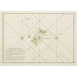
Plan des Iles de Mahé
From the second edition. French of Isle of Mahé in Seychelles. Prepared by Jacques-François L'Abbé Dicquemare (1733-1789). Latitude and longitude scales, compass rose...
Date: Paris, Brest, chez Demonville, 1775
Selling price: ????
Please login to see price!
Sold in 2014
Plan de lIsle de Rodrigues. / Plan particulier du Nord de l'Isle de Madagascar depuis le Cap d' Ambre jusqu'à Infandria. Plan particulier du Nord de l'Isle de Madagascar depuis le Cap d'Ambre jusqu'à Infandria.
French of Isle Rodrigue on East coast of Madagascar. Latitude and longitude scales, compass rose and system of rhumb lines, soundings near coast and in bay areas.D' Apr�...
Date: Paris, Brest, chez Demonville, 1775
Selling price: ????
Please login to see price!
Sold in 2011
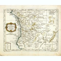
Empire du Monomotapa et Etats Voisins. . .
A small interesting map of the Kingdom of Monomotapa roughly in today's Mozambique. Based on Delisle, it includes the Zambeze River.Prepared by Jacques Nicolas Bellin and...
Date: Paris, 1738-1775
Selling price: ????
Please login to see price!
Sold in 2014
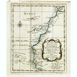
Coste occidentale d'Afrique depuis le Détroit de Gibraltar.
An interesting map of the North-West coast of Africa, from the Straits of Gibraltar to the Gambia River and Cachau. The detailed map includes the Canary Islands, Madeira,...
Date: Paris, 1738-1775
Selling price: ????
Please login to see price!
Sold in 2016
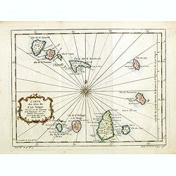
Carte des Isles du Cap Verd.
An interesting map of the islands of the Cap Verd.Prepared by Jacques Nicolas Bellin after Dutch sources and included in Prévost d' Exile's "Histoire des Voyages&qu...
Date: Paris, 1738-1775
Selling price: ????
Please login to see price!
Sold in 2016
Carte des Royaumes de Congo, Angola et Benguela, avec les Pays voisins.
An interesting map of the kingdoms of Congo, angola and Benguela .Prepared by Jacques Nicolas Bellin after Dutch sources and included in Prévost d' Exile's "Histoir...
Date: Paris, 1738-1775
Selling price: ????
Please login to see price!
Sold in 2014
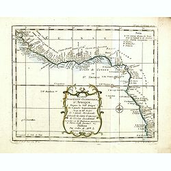
Carte de la Coste occidentale d'Afrique.
An interesting map of the West Coast of Equatorial Africa, from the Rio Grande in Senegal to just south of Angola .Prepared by Jacques Nicolas Bellin after Dutch sources ...
Date: Paris, 1738-1775
Selling price: ????
Please login to see price!
Sold in 2018
Carte des Isles du Cap-Verd. . .
A nice large chart of the Cape Verde Islands off the N.W. coast of Africa in the Atlantic Ocean. The Cape Verde Islands are an archipelago of ten volcanic islands, that w...
Date: Paris, ca 1775
Selling price: ????
Please login to see price!
Sold in 2020
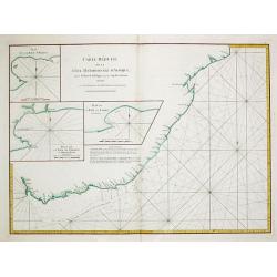
Carte Reduite de la Cote meridionale d' Afrique, depuis La Baye de Saldagne jusqu'au Cap des Courans.
A French sea chart of the southeast coast of South Africa from the 'Atlas Neptune Oriental' of 1775. It extends from Saldanha Bay to north of Cape Courans, including the ...
Date: Paris, Brest, 1775
Selling price: ????
Please login to see price!
Sold in 2021
Carte de la Guinée contenant les Isles du Cap Verd le Senegal, la Côtede Guinée proprement dite les Royaumes de Loango, Congo..
Detailed map of Southwest African coast, from Guinea to Congo.Santini gives credit to R.Bonne in the cartouche. With inset map of the "Gold Coast" after d'Anvil...
Date: Venise 1776
Selling price: ????
Please login to see price!
Sold
L'Africa divisa ne'suoi principali Stati di Nuova Projezione.
This attractive Italian map by Antonio Zatta is based on the earlier cartography of the Frenchman Janvier, and is quite accurate for the time period, although the source ...
Date: Venice, 1776
Selling price: ????
Please login to see price!
Sold in 2018
CARTE DE L'ARCHIPEL AU NORD DE L'ISLE DE FRANCE. . . - REUNION,MAURITIUS,SEYCHELLES,DIEGO GARCIA.
A rare, large, and fine antique naval chart, depicting the Indian Ocean from as low as Mauritius to the southernmost Maldives islands, with an inset map of the Seychelles...
Date: Paris, 1776
Selling price: ????
Please login to see price!
Sold in 2021
L?Afrique divisée en ses principaux Empires et Royaumes.
Gilles Robert de Vaugondy (!686-1766) and son Didier (1723-86), Paris geographers and publishers. Gilles succeedded Pierre Moulart Sanson in 1730. ' Atlas Portatif', 1748...
Date: Paris, Fortin, 1778
Selling price: ????
Please login to see price!
Sold in 2008
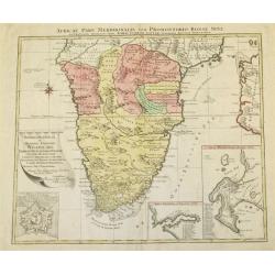
Africae Pars Meridionalis cum Promontorio Bonae Spei Accuratissime Delineato
A map of Southern Africa by T.Lotter [1717-1777]. The coastline still provides inaccurate information, while Hottentot tribes are illustrated throughout the mainland. The...
Date: Vienna, 1778
Selling price: ????
Please login to see price!
Sold
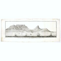
Vue du Cap de Bonne esperance de la baie / Gezigt van de Kaap der Goede hope van de reede.
A large rare panoramic view of Cape of Good Hope seen from the sea side with Dutch vessels in the foreground and Tafe-berg and the town in good detail. The fortress to th...
Date: Amsterdam, 1778
Selling price: ????
Please login to see price!
Sold in 2017
Carte de l'Egypte Ancienne et Moderne, dressee sur celle du R.P. Sicard et autres, assujetties aux observations astronomiques, par le Sr. Robert de Vaugondy
A splendid map of ancient Egypt, shows entire Nile valley in great detail. Large cartouche by Haussard shows ruins and a flirtatious sphinx.The map was prepared by the Ve...
Date: Venice, 1779
Selling price: ????
Please login to see price!
Sold in 2009
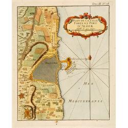
Plan de la Ville Fort et Port d'Alger.
This plan of Algiers, published originally in Bellin's Petit Atlas Maritime and was later issued in vol.III of the Abbé Prévost's "Histoire g&a...
Date: Paris c.1780
Selling price: ????
Please login to see price!
Sold
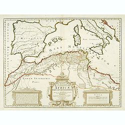
In notitiam ecclesiasticam Africae..
An engraved map of the Northern Africa coast, and the Mediterranean with good detail on the islands of Sardinia, Corsica, Majorca, Minorca, etc. Embellished with an uncol...
Date: Paris, 1780
Selling price: ????
Please login to see price!
Sold
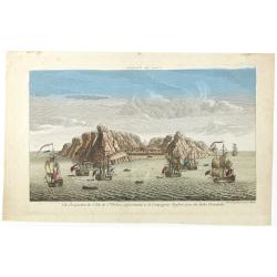
Vue perpective de l'Isle de St.Helene appartenant a la Compagnie Angloise pour les Indes Orientales.
Decorative optical view of St.Helena with in foreground British ships. The island is well-known as after Napoleon Bonaparte was captured by the Royal Navy, he was held ho...
Date: Paris, 1780
Selling price: ????
Please login to see price!
Sold in 2008
Vue du Cap de Bonne Esperance.
A fanciful, but rare optical print of the Cape of Good Hope". Published by Louis-Joseph Mondhare, who was a well-known publisher of optical prints, established from ...
Date: Paris, 1780
Selling price: ????
Please login to see price!
Sold in 2009
Cartes Particulieres des Isles de France, de Bourbon et de Rodrique.
An interesting map of islands east of Madagascar. From "Atlas de Toutes les Parties Connues du Globe Terrestre". Detailed with rivers, lakes, cities and mountai...
Date: Paris - 1780
Selling price: ????
Please login to see price!
Sold in 2013
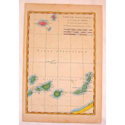
Carte des Isles Canaries.
Fine copper engraved map of The Canary Islands including Madiera & Porto Santo Islands. BONNE, RIGOBERT (1729-1795). Bonne was “Royal Hydrographer” and his princ...
Date: Paris, 1780
Selling price: ????
Please login to see price!
Sold in 2015
Negres de Kachao et de Bissao qui preparent le Manioc. (Brissau)
Engraving depict a typical scene of Africa, from "Histoire des Voyages..", by Prevost. Below title in Dutch "Negers van Kachao en Bissao, die Manioc bereid...
Date: Paris, Didot, ca. 1780
Selling price: ????
Please login to see price!
Sold in 2015
Guiriot ou negre jouant du balafo.
Engraving depict a typical scene of Africa, from "Histoire des Voyages..", by Prevost. Based on Barbot, showing a Griot or Negro playing the balafon on top, ins...
Date: Paris, Didot, ca. 1780
Selling price: ????
Please login to see price!
Sold in 2015
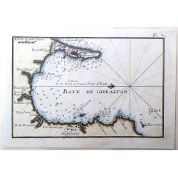
Baye de Gibraltar.
Fine miniature map featuring the Bay of Gibraltar. Hand colored copperplate by Joseph Roux in about 1780. Note that North is to the left.
Date: Paris, 1780
Selling price: ????
Please login to see price!
Sold in 2015
Partie Occidentale de L'Ancien Continent.
"Western part of the old continent, from Lisbon to the river Sierra Leona, etc." Antique map from the "Atlas de Toutes les Parties Connues du Globe Terrest...
Date: Paris, 1780
Selling price: ????
Please login to see price!
Sold in 2017
Carte de la Partie Septentrionale d'Afrique ou de la Barbarie.
A fine map of North Africa on the Mediterranean Sea. Containing the kingdoms of Tripoli, Tunis, of Algiers, Fez and Morocco.
Date: Paris, 1780
Selling price: ????
Please login to see price!
Sold in 2015
Habits des Negres du Cap Verd. / Kleedy der Negers aan Kabo Verde.
Inhabitants of Cape Verde.
Date: Paris, Didot, ca. 1780
Selling price: ????
Please login to see price!
Sold in 2017
Carte de la Haute et de la Basse Guinee Depuis la Riviere de Sierra Leona Jus qu' au Cap Negro.
A fine map of Africa's Guinea coast by Rigobert Bonne and G. Raynal's in 1780. The map corresponds to modern day Liberia, Ivory Coast, Ghana, Nigeria, Cameroon, Gabon, Co...
Date: Paris, 1780
Selling price: ????
Please login to see price!
Sold in 2017
Etats du Roi de Maroc. Les Royaumes D'Algier, de Tunis et de Tripoli, avec les Pays Circonvoisins.
A North African map of Algeria, Tunisia, and Tripoli by Raynal and Bonne in 1780. It is from Atlas of All Known Parts of Globe, Lists For Philosophical History and Polic...
Date: Paris, 1780
Selling price: ????
Please login to see price!
Sold in 2018
Carte de la Haute et de la Basse Guinee.
An engraved map showing the entire Guinea coast from the Sierra Leone River to Cape Negro. Locates many towns and villages, lakes and coastal features. Today this is Libe...
Date: Paris, 1780
Selling price: ????
Please login to see price!
Sold in 2019
L'Africa divisa ne' suoi principal stati.
Rare map of Africa, with Madagascar and Arabia, from "Atlante Novissimo ad uso Dei Giovani Studiosi Contenuto In Carte XXVII.", published by Giovanni Zempel in ...
Date: Rome, 1780
Selling price: ????
Please login to see price!
Sold in 2018
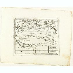
Barbaria, Egitto, Nigrizia, Guinea, Nubia Abissina.
Rare map of the northern half of Africa, from "Atlante Novissimo ad uso Dei Giovani Studiosi Contenuto In Carte XXVII.", published by Giovanni Zempel in Rome, c...
Date: Rome, 1780
Selling price: ????
Please login to see price!
Sold in 2021
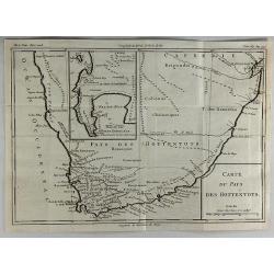
Carte du Pays des Hottentots.
A fine engraved map of The Cape of Good Hope in South Africa.It includes an inset of False Bay. Published in 1780 by Louis Brion de la Tour. Louis Brion de la Tour, (174...
Date: Paris, 1780
Selling price: ????
Please login to see price!
Sold in 2018
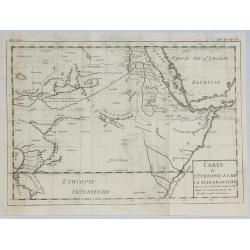
Carte de L'Ethiopie et de la Garamandtide.
A nice map of the Horn of Africa, including Ethiopia, Djibouti, Eritra and Sudan, by Brion de la Tour in Paris in 1780.Louis Brion de la Tour, (1743 –1803) was an 18th-...
Date: Paris, 1780
Selling price: ????
Please login to see price!
Sold in 2019
Vue perpective de l'Isle de St.Helene appartenant a la Compagnie Angloise pour les Indes Orientales.
Decorative optical view of St. Helena.
Date: Paris, 1780
Selling price: ????
Please login to see price!
Sold in 2018
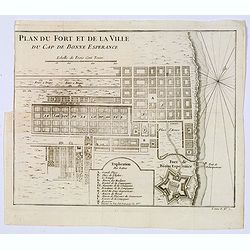
Plan du Fort et de la ville du Cap de Bonne Esperance.
Plan of the city, the fort and Good Hope Cape. With an explanation key to a list of 13 important sites and locations keyed to the plan with corresponding letters. Shows a...
Date: Paris, ca 1780
Selling price: ????
Please login to see price!
Sold in 2020
Le Kaire [Cairo.]
A very strong fine view of Cairo. Many pleasure boats are seen in the foreground, and many fine buildings front the shoreline. An attractive 'busy' print.
Date: Paris, ca 1780
Selling price: ????
Please login to see price!
Sold in 2021
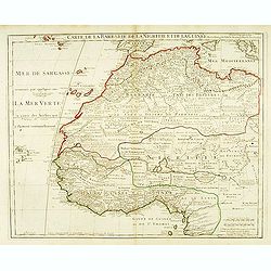
Carte de la Barbarie de la Nigritie et de la Guinée. . .
Detailed engraved map of north west Africa including the Canary and Cape Verde Islands. The title is displayed along the top of the map. In this map De L'Isle corrects hi...
Date: Paris, 1781
Selling price: ????
Please login to see price!
Sold in 2015
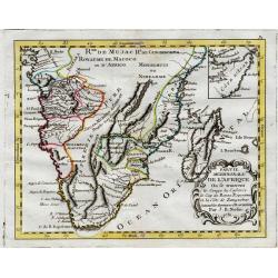
Partie Meridionale de L'Afrique.
An uncommon map of southern Africa, not listed in Tooley or Norwich. Scarce info on the interior, also has an inset of the horn of Africa top right. Large cartouche with...
Date: Paris, 1781
Selling price: ????
Please login to see price!
Sold
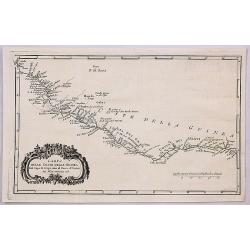
Carta Dell Coste Della Guinea Dal Capo di Verga Sino al Paese d'Issini.
A fine copperplate map of Sierra Leone, including Liberia and the Ivory Coast, from the Italian edition by D’Anville. It features a decorative Rococo cartouche. Jean Ba...
Date: Paris, 1781
Selling price: ????
Please login to see price!
Sold in 2018
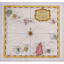
Carta dell Isole di Capo Verde.
A pleasant little map of the Cape Verde Islands off the coast of Africa, by Bellin in Paris dated 1781. This map is from the Italian edition. It features an attractive ti...
Date: Paris, 1781
Selling price: ????
Please login to see price!
Sold in 2017
Hottentots. / Caffres. (A pair of costume plates of Cape of Good Hope)
Engravings by Poisson after two paintings by Pierre Sonnerat (1748-1814). In the "Caffres" showing a family from what is now South Africa. The term "Kaffir...
Date: 1782
Selling price: ????
Please login to see price!
Sold in 2019
L'Afrique Suivant les dernier Mémoires de J.B.Nolin..
Rare map of the continent of Africa prepared after J.B.Nolin and published by Monhare for his Atlas Général a l'usage des colleges et maisons d'education.. Louis Joseph...
Date: Paris, 1783
Selling price: ????
Please login to see price!
Sold
Partie Méridionale de l'Afrique Ou se trouvent le Congo la Cafrerie le Cap de Bonne Espérance et la Côte de Zanguébar..
A rare map depicts Southern Africa from Mombasa on the east coast south to the Cape, and Isle St. Thomas on the west side, at the Equator southward to approximately 35deg...
Date: Paris, 1783
Selling price: ????
Please login to see price!
Sold
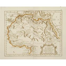
Partie Septentrionale de l'Afrique, Contenant l'Egipte, Nubie, l'Abissinie, la Barbarie Nigritie et la Guinée..
Rare map of the northern part of Africa, including Canaries. After J.B.Nolin and published by Monhare for his Atlas Général a l'usage des colleges et maisons d'educatio...
Date: Paris, 1783
Selling price: ????
Please login to see price!
Sold in 2009
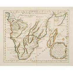
Partie de la Cote Orientale d' Afrique avec l' Isle de Madagascar et les Cartes particulières des Isles de France et de Bourbon..
A map of the south eastern coast of Africa and the island of Madagascar, comprehending 2 insets of the island of Bourbon (today Reunion) and Mauritius.From the Atlas mode...
Date: Paris ca 1783
Selling price: ????
Please login to see price!
Sold
Nubie et Abissinie..
Attractive map showing today Ethiopia and Eritrea. Ornated with a decorative title cartouche. Boundaries outlined in hand color.From theAtlas moderne ou collection de car...
Date: Paris, ca 1783
Selling price: ????
Please login to see price!
Sold
Carte des Côtes de Barbarie ou les Royaumes de Maroc.. Circonvoisins..
Attractive map of North Africa, ornated with a decorative title cartouche. Boundaries outlined in hand color.From theAtlas moderne ou collection de cartes sur toutes les ...
Date: Paris, ca 1783
Selling price: ????
Please login to see price!
Sold in 2011
Partie de la Cote Orientale D'Afrique avec l'Isle de Madagascar.. Isles de France et de Bourbon..
Attractive map of part of South Africa, including Madagascar and 2 insets with the Reunion and Mauritius Islands.Ornated with a decorative title cartouche. Boundaries out...
Date: Paris, ca 1783
Selling price: ????
Please login to see price!
Sold
L'Afrique divisée en ses principaux Etats..
Attractive map of Africa, ornated with a decorative title cartouche showing luxuriant nature and native animals. Boundaries outlined in hand color.Prepared by Le Sieur Ja...
Date: Paris, ca 1783
Selling price: ????
Please login to see price!
Sold
L'Afrique divisée en ses principaux Etats. . .
Attractive map of Africa, ornated with a decorative title cartouche showing luxuriant nature and native animals. Boundaries outlined in hand color.Prepared by Le Sieur Ja...
Date: Paris, ca 1783
Selling price: ????
Please login to see price!
Sold in 2011
L'Afrique suivant les dernier. . .
Scarce map of Africa, prepared by Nolin and published by L.J. Mondhare for his Atlas Général a l'usage des colleges et maisons d'education.. Louis Joseph Mondhare was a...
Date: Paris, 1783
Selling price: ????
Please login to see price!
Sold in 2014
Carte des Côtes de Barbarie ou les Royaumes de Maroc.. Circonvoisins...
Attractive map of North Africa, ornated with a decorative title cartouche. Boundaries outlined in hand color. From the "Atlas moderne ou collection de cartes sur tou...
Date: Paris, 1783
Selling price: ????
Please login to see price!
Sold in 2016




















![Le Kaire [Cairo.]](/uploads/cache/85334-250x250.jpg)
