Browse Listings in Africa
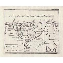
Aegypti Delta et Nili Ostia.
The Nile Delta by Christoph Cellarius from 'Geographia Antiqua'.
Date: Leipzig, 1755
Selling price: ????
Please login to see price!
Sold in 2013
[Two maps] Aegyptus Marmarica Et Cyrenaica\' and \'Africa Interior.
Present day Egypt from the Nile Delta and the Red Sea west to Libya.'Africa Interior' continues South to the source of the Nile with the White Nile and the Blue Nile in t...
Date: Leipzig 1755
Selling price: ????
Please login to see price!
Sold in 2013
[Two maps] Numidia et Mauretania\' and \'Syrtes Byzacium et Africa Propria.
The two maps cover the area from The Atlantic Ocean and Southern Spain in the West through to Libya in the East and the Mediterranean, Malta, and Sicily to the North, by ...
Date: Leipzig, 1755
Selling price: ????
Please login to see price!
Sold in 2013
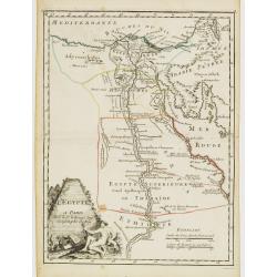
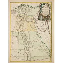
L'Egypte.
Fine map of Egypt. With decorative title cartouche. George Louis Le Rouge was active from 1740- till 1780 as a publisher, and was appointed engineer for the King of Franc...
Date: Paris, 1756
Selling price: ????
Please login to see price!
Sold in 2011
Afrique dresse sur les relation le plus recentes.
Gilles Robert de Vaugondy (!686-1766) and son Didier (1723-86), Paris geographers and publishers. Gilles succeedded Pierre Moulart Sanson in 1730. ' Atlas Portatif', 1748...
Date: Paris, 1756
Selling price: ????
Please login to see price!
Sold in 2017
L'Afrique dressée sur les relations les plus récentes et assujettie aux observations astronomiques. . .
Very attractive map of the whole of Africa from Atlas Universel. Title cartouche with Lion and palm trees.
Date: Paris, 1756
Selling price: ????
Please login to see price!
Sold in 2013
L'Afrique dressée sur les relations les plus récentes et assujettie aux observations astronomiques. . .
Very attractive map of the whole of Africa from Atlas Universel. Title cartouche with Lion and palm trees. Most of the text underneath the signature erased. A rare later ...
Date: Paris, after 1756
Selling price: ????
Please login to see price!
Sold in 2015
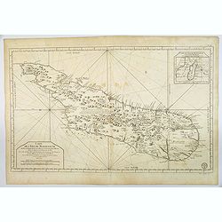
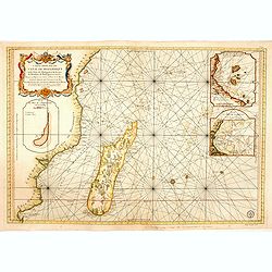
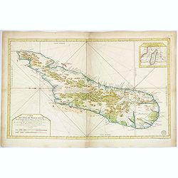
Carte de L'Isle de Madagascar. . .
A beautiful, large and quite detailed chart of the African island of Madagascar by Jacques Nicolas Bellin. The interior of the island is littered with forests, mountains,...
Date: Paris, ca 1756
Selling price: ????
Please login to see price!
Sold in 2018
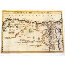
Egipten, Libie en Cirenaika.
Unusual map of Egypt & Libya. (Cirenaika historically was a region in Libya)
Date: Utrecht, 1757
Selling price: ????
Please login to see price!
Sold in 2015
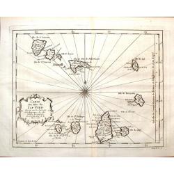
Carte des Isles du Cap Verd.
Featuring the Portugese Cape Verde Islands that are about 500 miles off the most western part of Africa in the Atlantic Ocean. Included are the islands of Bonavista, Sal,...
Date: Paris, 1757
Selling price: ????
Please login to see price!
Sold in 2016
Carte de la Rade de Benguella et Riviere de Cantonbelle.
Detailed map of the region of West Africa between Angola and Catumbela. Fort Kabuto is pointed out as probably being founded by the English.
Date: Paris, 1757
Selling price: ????
Please login to see price!
Sold in 2016
Carte du Cours des Rivieres de Falemeet Sanaga Dans les Pays de Bamucet Tamba Awra.
Interesting original map of western Mali with the Senegal and Niger Rivers showing the important Bambuk region. This is the area that has Cameroon gold mining. Engraved b...
Date: Paris, 1757
Selling price: ????
Please login to see price!
Sold in 2018
Le Pays des Hottentots aux environs du Cap de Bonne Espérance. . .
A good, competent, engraved map of Cape of Good Hope. The geographical features are typical, with somewhat exaggerated bays, inlets and prominent mountain ranges.The west...
Date: Paris, 1757
Selling price: ????
Please login to see price!
Sold in 2020
Carte De la Coste Orientale d' Afrique.
Jaques Nicolas Bellin (1702-720) was the most important French hydrographer of the 18th century. Sea-atlas 'Hydrographique Français' , 1756-65, atlas to accompany Prévo...
Date: Amsterdam, c. 1760
Selling price: ????
Please login to see price!
Sold in 2008
Carte des Isles du Cap Verde.
Jaques Nicolas Bellin (1702-720) was the most important French hydrographer of the 18th century. Sea-atlas 'Hydrographique Français' , 1756-65, atlas to accompany Prévo...
Date: Amsterdam, c. 1760
Selling price: ????
Please login to see price!
Sold
Carte . . . Congo, Angola et Benguela.
A map of the Congo and Angola as far south as Cape Negro.
Date: Amsterdam, c. 1760
Selling price: ????
Please login to see price!
Sold in 2009
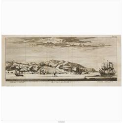
The Island of St.Helen.
A view of the island of St. Helena as seen from the sea. In the foreground English and Dutch V.O.C. ships.The island is well-known as after Napoleon Bonaparte was capture...
Date: London, c. 1760
Selling price: ????
Please login to see price!
Sold in 2008
LE CAP DE BONNE ESPERANCE.
Optical view illustrating the Cape of Good Hope, a stop-over for the V.O.C., by Daumont who was a well-known publisher of optical prints, established in Paris.In the eigh...
Date: Paris 1760
Selling price: ????
Please login to see price!
Sold in 2010
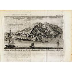
Tanger, Citta Marittima del Regno di Fez sulla Costa di Barbaria, nell'Africa.
Curious and decorative town-view of Tanger in Morocco. Several sailings ships are shown, the city with fortified walls and towers and many buildings. Unidentified and rar...
Date: ca. 1760
Selling price: ????
Please login to see price!
Sold in 2014
Carte de la Coste Occidentale d' Afrique depuis le XIe. Degré jusqu'au Cap de Bonne Esperance.
A map of the west coast of South Africa with the Cape of Good Hope. With a nice title-cartouche. From a Dutch edition of Prevost's "Voyages".Jacques Nicolas Bel...
Date: Amsterdam, c. 1760
Selling price: ????
Please login to see price!
Sold in 2020
Africa Secundum legitimas Projectionis Stereographicae regul..
An ornate title consisting of a panel surrounded by elephant's tusks rests on a piece of masonry containing a long description. With an interview between Europeans and Af...
Date: Nuremberg, ca. 1760
Selling price: ????
Please login to see price!
Sold in 2012
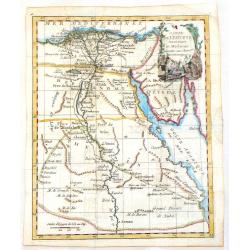
Carte de L\'Egypte Ancienne et Moderne.
A map of Egypt featuring the River Nile down to Assuan. Decorated with a cartouche. JEAN LATTRE ( 1743 - 1793) was a Paris based bookseller, engraver, and map publisher a...
Date: Paris, c1760
Selling price: ????
Please login to see price!
Sold in 2013
Description Générale De L'Afrique.
Decorative map of Africa. Only limited interior detail. Side panels of text with lengthy information on the various regions.
Date: Paris, ca. 1760
Selling price: ????
Please login to see price!
Sold in 2014
Plan de l' Isle de Gorée, sur les desseins du Sr. Compagnon.
Jan van Schley is the engraver of the maps (by J.N. Bellin) and views in the Dutch edition of A.F. Prévost d' Exile's 'Histoire Géneral des Voyages'.A plan of the islan...
Date: Amsterdam, c. 1760
Selling price: ????
Please login to see price!
Sold in 2018
Plan de la Ville et des Forts de St. Jago
Jan van Schley is the engraver of the maps (by J.N. Bellin) and views in the Dutch edition of A.F. Prévost d' Exile's 'Histoire Géneral des Voyages'.Plan of the town an...
Date: Amsterdam, c. 1760
Selling price: ????
Please login to see price!
Sold in 2018
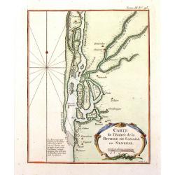
Carte de l' Entree de la Riviere de Sanaga ou Senegal.
Jaques Nicolas Bellin (1702-720) was the most important French hydrographer of the 18th century. Sea-atlas 'Hydrographique Français' , 1756-65, atlas to accompany Prévo...
Date: Amsterdam, c. 1760
Selling price: ????
Please login to see price!
Sold in 2018
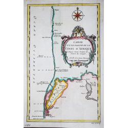
Carte d' une partie de la Coste d' Afrique Depuis Tanit jusq'a la Riviere de Senegal.
Jaques Nicolas Bellin (1702-720) was the most important French hydrographer of the 18th century. Sea-atlas 'Hydrographique Français' , 1756-65, atlas to accompany Prévo...
Date: Paris, c. 1760
Selling price: ????
Please login to see price!
Sold in 2018
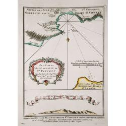
Plan de la Baye de l' Isles de St. Vincent / Vue de l' Isles de St. Vincent.
Jaques Nicolas Bellin (1702-720) was the most important French hydrographer of the 18th century. Sea-atlas 'Hydrographique Français' , 1756-65, atlas to accompany Prévo...
Date: Amsterdam, c. 1760
Selling price: ????
Please login to see price!
Sold in 2018
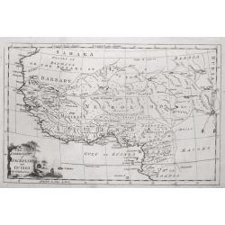
A New & Correct Map of Negroland and Guinea, by G.Rollos Geogr.
A detailed copper engraved map of West Africa published in Fenning's ‘A New System of Geography’.
Date: London, 1760
Selling price: ????
Please login to see price!
Sold in 2018
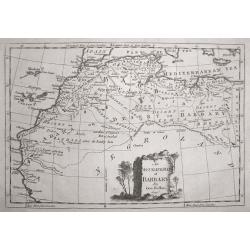
An Accurate Map of Barbary, by G.Rollos Geogr.
A detailed copper engraved map of North Eest Africa published in Fenning's ‘A New System of Geography’.
Date: London, 1760
Selling price: ????
Please login to see price!
Sold in 2014
Carte des Isles de Comore Johanna.
Decorative map of the Comoros Islands, to the north of Madagascar.Includes the islands of Komoro, Mohilla, Anjuan and Mayotta. Adorned with a large fancy title cartouche....
Date: Paris, 1760
Selling price: ????
Please login to see price!
Sold in 2017
Afrique
A copper engraved map of the African continent. There is little detail to the coastal and northern regions, with a mostly blank interior. The majority of Africa is simply...
Date: Paris, 1760
Selling price: ????
Please login to see price!
Sold in 2016
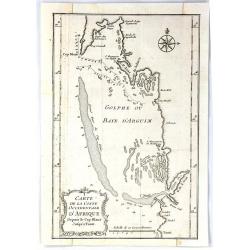
Carte de la Coste Occidentale D'Africa Depuis le Cap Blanc Jusqu'a Tanit
This map depicts the west coast of Africa along Mauritania, detailing the area around the Bay of Arguin.Islands, capes, and important towns surrounding the bay are labele...
Date: Paris, 1760
Selling price: ????
Please login to see price!
Sold in 2017
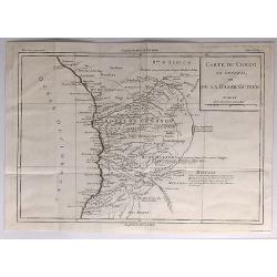
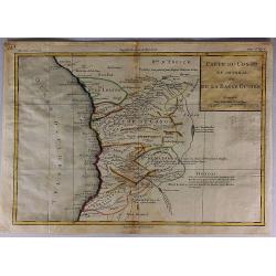
Carte du Congo en General ou de la Basse Guinnee.
A detailed map of the west coast of Africa, from Gabon to Namibia, and featuring the Congo. With detail and notations concerning recent explorations. Title in a plain blo...
Date: Paris, 1760
Selling price: ????
Please login to see price!
Sold in 2017
Carte du Congo en General ou de la Basse Guinee.
A detailed map of the west coast of Africa, from The Gabon to Namibia. Filled with detail and notations concerning recent explorations. Title in block style.Louis Brion d...
Date: Paris, 1760
Selling price: ????
Please login to see price!
Sold in 2017
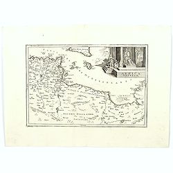
Africa Propria.
A map showing the North African coastlines of Tunisia and Libya, also to the north are a part of Sicily and the island of Malta and the surrounding smaller islands. The m...
Date: London ca. 1760
Selling price: ????
Please login to see price!
Sold in 2018
Africa Secundum legitimas Projectionis Sterographicae regulas. . .
Johann Matthias Haas's revision J.B. Homann's 1715 map of Africa, augmented to include important cartographic developments as recorded by Guillaume Delisle and D'Anville....
Date: Nuremberg, ca 1760
Selling price: ????
Please login to see price!
Sold in 2020
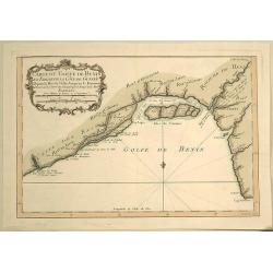
Carte du Golfe de Benin et Parte de la Cote de Guinee.
Attractive map of the infamous Slave Coast and the mouth of the Congo River showing soundings, anchorages and good coastal detail. The map features many place names, inc...
Date: Paris, 1760
Selling price: ????
Please login to see price!
Sold in 2019
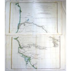
Carte particuliere de la Cote Occidnetale de L'Afrique.
Very large two-piece map of the West African coast from Cap de Verga to Cap Blanc. High detail along coast and main rivers. (Gambia & Senegal)Jean Baptiste d'Anville ...
Date: Paris, 1761
Selling price: ????
Please login to see price!
Sold in 2016
A Large Chart of the Coast of Guinea From Sherbro To Cape Lopas
A large coastal sea chart with rhumb lines of mainly the Gold Coast, by Francis Lamb, published in 'The English Pilot, part V, 6th edition', London, Mount and Page, 1761....
Date: London, 1761
Selling price: ????
Please login to see price!
Sold in 2022
Carte de l'Egypte Ancienne et Moderne.
Jean Lattré, Paris-based engraver and publisher. Worked with Robert de Vaugondy, J. Janvier and R. Bonne. " Atlas Monderne', 1771, 1783 , 1793. Rigobert Bonne, Fren...
Date: Paris, 1762
Selling price: ????
Please login to see price!
Sold in 2019
L'Afrique divisee en ses principaux etats par le sr. Janvier..
Excellent copper engraved map of the continent showing the extent of knowledge in the mid 18th century.While mostly accurate, it does have remnants of fantasy such as the...
Date: Paris 1762
Selling price: ????
Please login to see price!
Sold
De Stad Algiers.
A view of the town of Algiers as seen from the sea.
Date: Amsterdam, 1762
Selling price: ????
Please login to see price!
Sold in 2020
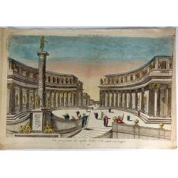
Vue Perspective du Superbe Palais d'Aexandre en Egypte.
A fine hand colored 'vue perspective' of the Hernandre Palais in Egypt. It was produced and hand colorued in Paris at Chez Mondare in 1762.Vues d'optique, was a special t...
Date: Paris, 1762
Selling price: ????
Please login to see price!
Sold in 2019
Kaart van Afrika door den Heer D'Anville, Te Amsterdam/ By Isaak Tirion, 1763.
A copper engraved map, overall size 37 x 42 cm.Very detailed map of the African continent by Tiron, after D'Anville, from:' Hedendaagsche Historie of Tegenwoordige Staat ...
Date: Amsterdam, 1763
Selling price: ????
Please login to see price!
Sold in 2016
Africa.
Uncommon miniature map of Africa, engraved by Thomas Kitching for "A New General and Universal Atlas Containing Forty five Maps by Andrew Dury".This miniature a...
Date: London, 1761-1763
Selling price: ????
Please login to see price!
Sold in 2016
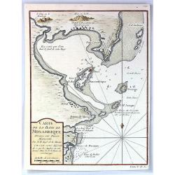
Carte de la Baye de Mosambique, Dressee sur Divers Manuscrits
A fine map of the Bay of Mozambique by Belling in Paris in 1763.Jaques Nicolas Bellin (1702-1772) was the most important French hydrographer of the 18th century. Some of ...
Date: Paris, 1763
Selling price: ????
Please login to see price!
Sold in 2016
Nieuwe Kaart van de KAAP DER GOEDE HOOPE en der na by gelegen Landen.
An old colored map of the Cape of Good Hope in South Africa showing mountains and naming towns, rivers and shore locations. With large margins.
Date: Amsterdam, 1763
Selling price: ????
Please login to see price!
Sold in 2019
[68] Barbarie.
Charming of the coast near to Sfax and the island of Djerba. Showing town and harbour plan, with soundings, anchorages, rocks, shoals, fortifications and lighthouses.Jos...
Date: Marseille, 1764
Selling price: ????
Please login to see price!
Sold in 2014
[70] Tunis.
Charming chart of the coasts near the town of Tunis. Showing town and harbour plan, with soundings, anchorages, rocks, shoals, fortifications and lighthouses.Joseph Roux ...
Date: Marseille 1764
Selling price: ????
Please login to see price!
Sold in 2014
[73] Barbarie. Oran..
"Charming chart of the harbour of the town of Oran in Algeria. Showing town and harbour plan, with soundings, anchorages, rocks, shoals, fortifications and lighthous...
Date: Marseille 1764
Selling price: ????
Please login to see price!
Sold in 2014
[75] Barbarie.. Mamora.. Salee
"Charming chart of including the harbours of Mamora, Salee, etc. Showing town and harbour plan, with soundings, anchorages, rocks, shoals, fortifications and lightho...
Date: Marseille 1764
Selling price: ????
Please login to see price!
Sold in 2014
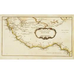
Carte des Costes de Guinée.
A very rare map of western part of Africa with the Ivory coast, from Le Commerce de l'Amérique par Marseille, ou Explication des Lettres-Patentes du Roi, portant Regleme...
Date: Avignon 1764
Selling price: ????
Please login to see price!
Sold
Carte du pais des Hottentots aux environs du Cap de Bonne Esperance.
Bellin\'s scarce vertical edition of the Cape of Good Hope. A finely colored engraving of the south-eastern coast of Africa around Cape Town. From the Le Petit Atlas Mari...
Date: Paris, 1764
Selling price: ????
Please login to see price!
Sold in 2008
Carte de L'Entree de la Riviere de Sanaga ou Senegal.
The Sanaga River is a river of South Province, Cameroon. The map was published in 1764 by Nicholas Bellin in Paris.
Date: Paris, 1764
Selling price: ????
Please login to see price!
Sold in 2016
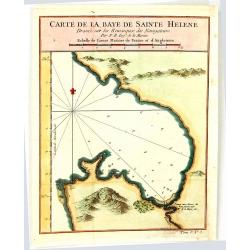
Carte de la Baye de Sainte Helene
An attractive outline chart of the coast of St Helena Bay, northwest of Cape Town, on the Atlantic coast of South Africa, by Bellin, the leading French hydrographer of th...
Date: Paris, 1764
Selling price: ????
Please login to see price!
Sold in 2016
Carte de la Baye de Sainte Helene.
A map of St. Helena Bay on the Atlantic coast of South Africa. From the Dutch edition of Prevost's' Voyages'.Jaques Nicolas Bellin (1702-1772) was the most important Fren...
Date: Paris, 1764
Selling price: ????
Please login to see price!
Sold in 2016
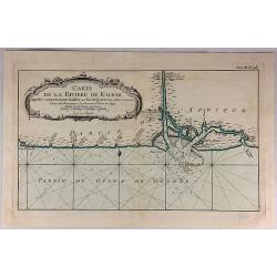
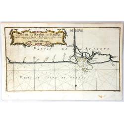
Carte de la Riviere de Kalbar...
A detailed coastal map of this Guinea coast area of Western Africa, based upon the 1699 voyage of James Barbot & John Grazilhier to New Kalabar, Bandi, and Doni River...
Date: Paris, 1764
Selling price: ????
Please login to see price!
Sold in 2018
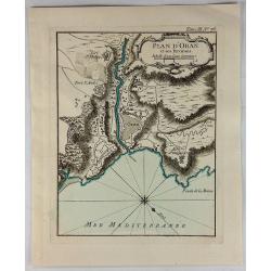
Plan D'Oran et Ses Environs.
A fine nautical chart of the fortified city of Oran in Algeria. It was published in LE PETIT ATLAS MARITIME. It features a decorative cartouche. Jacques Bellin (1703 – ...
Date: Paris, 1764
Selling price: ????
Please login to see price!
Sold in 2018
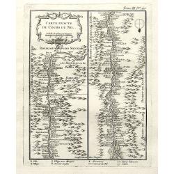
Carte exacte du cours du Nil.
A very detailed map of the Nile river. The banks are filled with place names of forts and villages. The river mouth is at the foot of the map. With a decorative title car...
Date: Paris, 1764
Selling price: ????
Please login to see price!
Sold in 2018
Carte de la Baye de la Table, et Rade du Cap de Bonne Esperance.
This nicely hand colored map is a copperplate map of the Cape of Good Hope, and of Cape Town, in South Africa. This map was issued both in Bellin's Le Petit Atlas Maritim...
Date: Paris, 1764
Selling price: ????
Please login to see price!
Sold in 2018
Plan d'Oran et Ses Environs.
A fine nautical chart of the fortified city of Oran in Algeria. It was published in “LE PETIT ATLAS MARITIME”. It features a decorative cartouche. Jacques Bellin (170...
Date: Paris, 1764
Selling price: ????
Please login to see price!
Sold in 2019
Carte de la Baye de la Table, et Rade du Cap de Bonne Esperance.
A nice copperplate map of the Cape of Good Hope, and of Cape Town, in South Africa. This map was issued both in Bellin's Le Petit Atlas Maritime and in the French edition...
Date: Paris, 1764
Selling price: ????
Please login to see price!
Sold in 2021
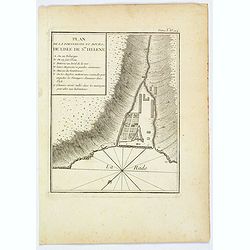
Plan de la Forteresse et Bourg, de Lisle de Ste. Helene.
A plan of the Fortress and Borough on the island of St. Helena by Bellin. With an inset legend of several important items and places of note, including the Govenor's hous...
Date: Paris, 1764
Selling price: ????
Please login to see price!
Sold in 2021
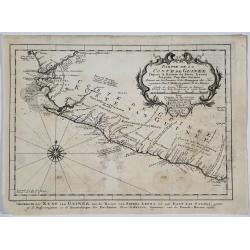
Partie de la Coste de Guinee.
A detailed map of the Guinea coast in West Africa, from the Sierra Leone River to Cape Palmas on the southern coast of what is now Liberia, from the atlas of Prevost d'Ex...
Date: Paris, 1764
Selling price: ????
Please login to see price!
Sold in 2019
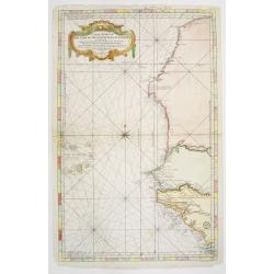
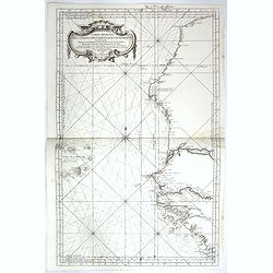
Carte Reduite des Costes Occidentales d'Afrique seconde feuille depuis le Cap Bojador jusqu'a la Riviere de Sierra Leona pour le service des Vaisseaux du Roy... Seconde feuille..
Sea chart of the West African coast, from Sierra Leone to southern Morocco, and including the Cape Verde Islands and part of the Canaries, all at a scale of about 1:3,000...
Date: Paris 1754 corrected in 1765
Selling price: ????
Please login to see price!
Sold
Carte de la Riviere de Kalbar.
A splendid coastal map of this Guinea coast area of Western Africa, the chart is based upon the 1699 voyage of James Barbot & John Grazilhier to New Kalabar, Bandi, a...
Date: Paris, 1765
Selling price: ????
Please login to see price!
Sold in 2016
Carte Reduite des Costes Occidentales d'Afrique seconde feuille depuis le Cap Bojador jusqu'a la Riviere de Sierra Leona pour le service des Vaisseaux du Roy... Seconde feuille..
Sea chart of the West African coast, from Sierra Leone to southern Morocco, and including the Cape Verde Islands and part of the Canaries, all at a scale of about 1:3,000...
Date: Paris, 1753 corrected in 1765
Selling price: ????
Please login to see price!
Sold in 2018
Carte de L'Isle de Madagascar. . .
A fine early sea chart of the African island of Madagascar, published by the French Hydrographical Department. An attractive large-scale chart full of interesting topogra...
Date: Paris, 1765
Selling price: ????
Please login to see price!
Sold in 2019
L' Afrique.
Louis Brion de la Tour (1756-1823), ' Atlas Géneral, Civil et Ecclésiastique', 1766, ' Atlas Général', 1790-98. Louis Charles Desnos (fl.1750-70), Le Rouge's 'Atlas N...
Date: Paris, 1766
Selling price: ????
Please login to see price!
Sold in 2016
Carte Reduite de CANAL DE MOZAMBIQUE et des Isles de Madagascar de France de Bourbon, de Rodrigues et autres. Dressee au Depost des Cartes et Plans de Marine Pour Servir aux Vaisseau du Roy . . .
A beautiful large sea chart of the Mozambique Channel, published by the French Hydrographical Department. It includes a detailed treatment of Madagascar and the contiguo...
Date: Paris, 1767
Selling price: ????
Please login to see price!
Sold in 2020
An Accurate Map of Africa..
An Accurate Map of Africa from the Latest Improvements A nice copperplate engraved map from Edward Cavendish Drake's "A new Universal Collection of Authentic and Ent...
Date: London, 1768
Selling price: ????
Please login to see price!
Sold
Carte réduite du canal de Mozambique et des isles de Madagascar de France de Bourbon, de Rodrigues et autres. . .
Very large and detailed chart depicting Southern Africa, with Insets: Plan de l'isle de l'Assomption et de son mouillage. -- Plan du port de Secheyles dans l'isle de ce n...
Date: Paris, ca. 1768
Selling price: ????
Please login to see price!
Sold in 2014
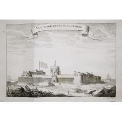
Vue nord ouest du Cap Corse.
The English fortresses at Cape Corse.From a French edition of Prévost d' Exile's ' Histoire. des Voyages', 1738-75.
Date: Paris, 1769
Selling price: ????
Please login to see price!
Sold in 2018
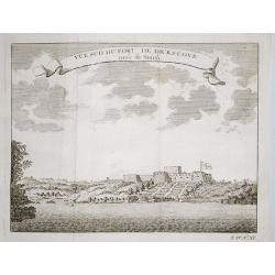
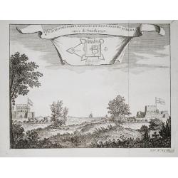
Plan of the English fortresses at Dickscove Vue du sud du fort de Dickscove.
The English fortresses at Dickscove.From a French edition of Prévost d' Exile's ' Histoire. des Voyages', 1738-75.
Date: Paris, 1769
Selling price: ????
Please login to see price!
Sold in 2020
Vue nord des forts anglois et Hollandois d'Akra.
The Dutch and English forts at Accra. From a French edition of Prévost d' Exile's "Histoire des Voyages", 1738-1775. Crevecoeur, the Dutch fort and the English...
Date: Paris, 1769
Selling price: ????
Please login to see price!
Sold in 2018
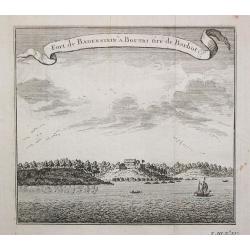
Fort de Badenstein a Boutri.
Fortress Badenstein at Boutri.From a French edition of Prévost d' Exile's ' Histoire. des Voyages', 1738-75.
Date: Paris, 1769
Selling price: ????
Please login to see price!
Sold in 2018
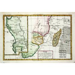
Carte du canal de Mosambique, contenant l' Isle de Madagascar avec les Côtes d' Afrique depuis le Cap de Bonne Esperance jusqu'a Melinde
Rigobert Bonne (1727-1795), French cartographer. His maps are found in a.o. Atlas Moderne (1762), Raynal's Histoire Philos. du Commerce des Indes (1774) and Atlas Encyclo...
Date: Paris, c. 1770
Selling price: ????
Please login to see price!
Sold
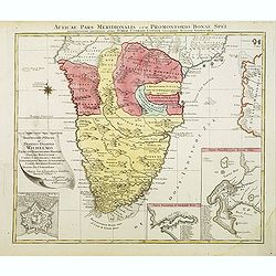
Africae Pars Meridionalis.
There are three detailed insets : the Cape Fort, Saldanda Bay and the Cape of Good Hope, all with a detailed identifying legend.
Date: Augsburg, 1770
Selling price: ????
Please login to see price!
Sold in 2008
Africa concinnata secundum observationes...
Lotter gives credit in the title cartouche to Guillaume De L'Isle. The Nile is correctly shown with its origins in Abyssinia and the other major rivers are shown fairly a...
Date: Augsburg, ca.1770
Selling price: ????
Please login to see price!
Sold in 2012
![[Two maps] Aegyptus Marmarica Et Cyrenaica\' and \'Africa Interior.](/uploads/cache/92137-250x250.jpg)
![[Two maps] Numidia et Mauretania\' and \'Syrtes Byzacium et Africa Propria.](/uploads/cache/92139-250x250.jpg)















![[68] Barbarie.](/uploads/cache/12840-250x250.jpg)
![[70] Tunis.](/uploads/cache/12842-250x250.jpg)
![[73] Barbarie. Oran..](/uploads/cache/12845-250x250.jpg)
![[75] Barbarie.. Mamora.. Salee](/uploads/cache/12905-250x250.jpg)
