Browse Listings in Africa
Coste de Guinee Depuis le Cap Apollonia Jusqu'a la Riviere de Volta ou La Coste d'Or.
Bellin's detailed map of the Guinea coast in west Africa, from Cape Appollonia to the mouth of the Volta River in what is now Ghana (the Gold Coast), from the atlas of Pr...
Date: Paris, 1747
Selling price: ????
Please login to see price!
Sold in 2016
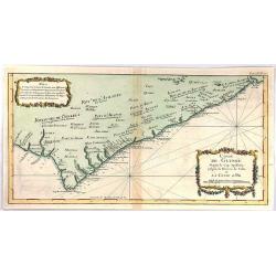
Partie de la Coste de Guinee Depuis le Cap de Monte Jusqu'au Cap des Basses;
A fine little map engraved by Schley featuring the coast of Guinee in Western Africa. The insert is of the Sestos River.With a pleasing floral, title cartouche. The map w...
Date: Paris, 1747
Selling price: ????
Please login to see price!
Sold in 2019
L'Afrique Suivant les Dern.res Observations de Mr. Hass et des R.R.P.P. Jesuites.
A large map of the continent of Africa with a decorative title cartouche. Informational table upper left explaining the countries that comprise northern and southern Afri...
Date: Paris, 1747
Selling price: ????
Please login to see price!
Sold in 2017
Isle de Madagascar autrement Isle de St. Laurent . . .
Detailed map of the island of Madagascar, from Jacques-Nicolas Bellin (1703-1772) the most important mapmakers of the 18th Century.
Date: Paris, 1747
Selling price: ????
Please login to see price!
Sold in 2022
Isle de Madagascar Autrement Isle de St. Laurent.
An attractive map of the island of Madagascar marking its settlements and topography, by Bellin from Prevost's "Histoire Generale des Voyages".Jacques Nicolas B...
Date: Paris, 1747
Selling price: ????
Please login to see price!
Sold in 2020
Gezigt van de Kaap de Goede-Hoop.
A small view of the Cape of Good Hope, and featuring a plan of the fort and map of the bay. There is also a numbered table (1-14) at top. Engraved when the Dutch had a co...
Date: Amsterdam, 1747
Selling price: ????
Please login to see price!
Sold in 2019
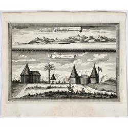
Vue des Montagnes nommées Sierra Leona.
Two views of Sierra Leone. French & Dutch text.
Date: Amsterdam, 1747
Selling price: ????
Please login to see price!
Sold in 2019
[2 prints] Cadaver balsamo conditum... / Loculi Conspectus anterior auctior...
Two attractive copper-engravings showing a sarcophagus in great detail. Engraved by James Basire, drawn by George Vertue, published in the first volume of Vetusta Monumen...
Date: London, 1747
Selling price: ????
Please login to see price!
Sold in 2019
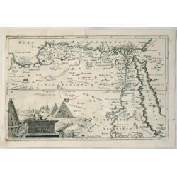
A Map of Ancient Egypt.
A detailed map of Egypt on the Red Sea with Nubia, Arabia by Cellerius in 1747. It features a cartouche of the pyramids.Andreas Cellarius (1596-1665) was an astronomer, m...
Date: Amsterdam, 1747
Selling price: ????
Please login to see price!
Sold in 2020
L´AFRIQUE Suivant les Nouvelles Observations
Le Rouge was an eighteenth-century French hydrographer and cartographer appointed Ingenieur Geographe du Roi to King Louis XV. He was a military engineer who specialized ...
Date: Paris, 1748
Selling price: ????
Please login to see price!
Sold
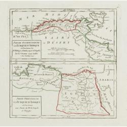
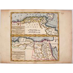
Partie Occidentale de la Turquie d'Afrique.. / Partie Orientale de la Turquie d'Afrique..
Two small detailed maps on one plate representing the seacoasts of North Africa. From Atlas Portatif Universel, by Robert de Vaugondy.Page 76 outside border top right.
Date: Paris, 1748
Selling price: ????
Please login to see price!
Sold in 2014
Cote Occidentale d'Afrique.. Canaries.
Nice small map illustrating the African shores of Morocco and Western Sahara. The Canary Islands and the Madeira Islands are also shown.From Atlas Portatif Universel, by ...
Date: Paris, later than 1748
Selling price: ????
Please login to see price!
Sold in 2017
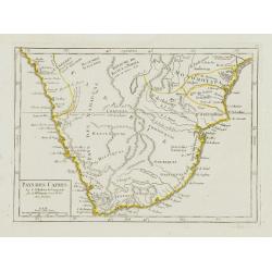
Pays des Cafres.
Charming small map of Southern Africa. From Atlas Portatif Universel, by Robert de Vaugondy.Page 82 outside border top right. Mary Sponberg Pedley does not mention a stat...
Date: Paris, later than 1748
Selling price: ????
Please login to see price!
Sold in 2023
L'Afrique Divisée en ses principales Parties.
Small detailed map of the African continent. Dated 1748. From Atlas Portatif Universel, by Robert de Vaugondy. 75 outside border top right. Mary Sponberg Pedley does not ...
Date: Paris, later than 1748
Selling price: ????
Please login to see price!
Sold in 2013
Cote de Zanguebar. . .
Nice small map showing a long stretch of the central Africa east coast. From Atlas Portatif Universel, by Robert de Vaugondy.Page 83 outside border top right. Mary Sponbe...
Date: Paris, later than 1748
Selling price: ????
Please login to see price!
Sold in 2014
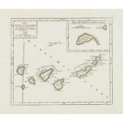
Les Isles Canaries. / Isles de Madere et Porto-Santo.
Charming small map of the Canary Islands. With an inset map of the Madeira Islands in the upper right corner. "Premier Meridien fixe à l'Isle de Fer par la Declarat...
Date: Paris, later than 1748
Selling price: ????
Please login to see price!
Sold in 2012
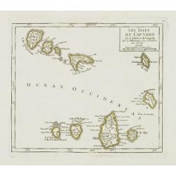
Les Isles du Cap-Verd. . .
Charming small map of the archipelago of Cape Verde. From Atlas Portatif Universel, by Robert de Vaugondy.From Atlas Portatif Universel, by Robert de Vaugondy.Page 87 out...
Date: Paris, later than 1748
Selling price: ????
Please login to see price!
Sold in 2011
Partie Occidentale (Orientale) de la Turquie D'Afrique.
Two detailed maps on one sheet, featuring the Barbary Coast region of the North African seacoast. It is from "ATLAS PORTATIF UNIVERSAL" by Robert de Vaugondy.
Date: Paris, 1748
Selling price: ????
Please login to see price!
Sold in 2014
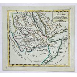
Nubie, Abissinie et Cote D'Ajan.
A fine map of Abyssinia, Sudan and the Red Sea covering Arabia, Egypt south to Mogadishu. It was published in the 1748 edition of the de Vaugondy's "ATLAS PORTRATIF ...
Date: Paris, 1748
Selling price: ????
Please login to see price!
Sold in 2023
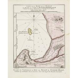
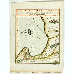
Carte de la Baye de la Table .. / Cap de Bonne Esperance.
A very nice map of the Cape of Good Hope.From Atlas Portatif pour servir a l'intelligence de l'Histoire Philosophique et Politique des etablissements et du commerce des E...
Date: Amsterdam 1749
Selling price: ????
Please login to see price!
Sold
Carte de la Baye de la Table .. / Cap de Bonne Esperance.
A very nice map of the Cape of Good Hope.From Atlas Portatif pour servir a l'intelligence de l'Histoire Philosophique et Politique des etablissements et du commerce des E...
Date: Amsterdam, 1749
Selling price: ????
Please login to see price!
Sold in 2011
Partie Occidentale de la Nigritie et de la Haute Guinée.
Nice small map illustrating the West African shores between Mauritania and Benin. From Atlas Portatif Universel, by Robert de Vaugondy. 78, Pag.566 outside border top rig...
Date: Paris, later than 1749
Selling price: ????
Please login to see price!
Sold in 2013
Cours de la Riviere de Sénégal. Depuis le Rocher Gouinea jusqu'à la Mer.
3 small maps in one plate. Illustrating the stretch of the Senegal River constituting the natural border between Senegal and Mauritania. Dated 1749.From Atlas Portatif Un...
Date: Paris, later than 1749
Selling price: ????
Please login to see price!
Sold in 2013
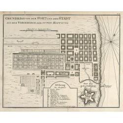
Grundriss von dem Fort und der Stadt auf dem Vorgebirge der Guten Hoffnung
Engraved map of Cape Town in South Africa by Nicolas Bellin. From the German edition of Prévost's "L'Histoire Générale des Voyages" by J. J. Schwabe in Leipz...
Date: Leipzig, 1749
Selling price: ????
Please login to see price!
Sold in 2008
Afrique publiée sous les auspices de Monseigneur le Duc d'Orléans. . .
Very fine engraved wall map of Africa with a very decorative title cartouche. Giving good detail along the coast. Uncommon.
Date: Paris, 1749
Selling price: ????
Please login to see price!
Sold in 2008
Africa verfertiget von J. G. Schreibern in Leipzig
Small scale map of Africa by J. G. Schreiber, from his Atlas Selectus in 1749, first published in 1740. Nice cartouche with elephant, lion and palm trees.
Date: Leipzig, 1749
Selling price: ????
Please login to see price!
Sold in 2009
Das Reich der Monomotapa und dessen benachbarte Staaten.
Engraved map of Mozambique in Southeast Africa by Nicolas Bellin. From the German edition of Prévost's "L'Histoire Générale des Voyages" by J. J. Schwabe in ...
Date: Leipzig, 1749
Selling price: ????
Please login to see price!
Sold in 2009
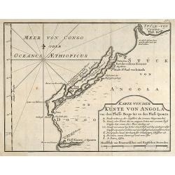
Karte von der Küste von Angola von dem Flusse Bengo bis an den Fluß Quanza.
Engraved map of the coastal line of Angola in Southwest Africa by Nicolas Bellin. From the German edition of Prévost's "L'Histoire Générale des Voyages" by J...
Date: Leipzig, 1749
Selling price: ????
Please login to see price!
Sold in 2010
Eyland Madagascar sonst Insel St Laurentius
Engraved map of the Island of Madagascar in the Indian Ocean by Nicolas Bellin. From the German edition of Prévost's L'Histoire Générale des Voyages by J. J. Schwabe i...
Date: Leipzig, 1749
Selling price: ????
Please login to see price!
Sold in 2009
L'Afrique divisé en ses principaux et Royaumes.
This is the uncommon first state. With table to the right. First issued in 1749 and it went through at least seven states with editions appearing as late as 1810. The sta...
Date: Paris, 1749
Selling price: ????
Please login to see price!
Sold in 2018
Congo ou Basse Guinee.
Little hand colored Vaugondy map featuring a section of the west coast of Africa, centered on Angola. It is from "Atlas Portatif, Universel et Militaire", publi...
Date: Paris, 1749
Selling price: ????
Please login to see price!
Sold in 2016
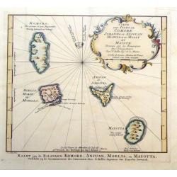
Carte des Isles de Johanna ou Anjouan Mohilla ou Moaly et Mauote.
Decorative map of the Comoros Islands to the north of Madagascar east of Africa. The map maker was N. Belin and the engraver was J. Van Der Schley.
Date: Paris, 1749
Selling price: ????
Please login to see price!
Sold in 2016
[2 sheet wall map] Afrique publiée sous les auspices de Monseigneur le Duc d'Orléans Prémier Prince du Sang..
A large, two sheet folding map of Africa, can be joined to make a wall map. Prepared and published by the great Jean Baptiste Bourguignon d'Anville (1697-1782).An ornamen...
Date: Paris, 1749
Selling price: ????
Please login to see price!
Sold in 2017
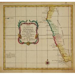
Coste Occidentale d' Afrique depuis le XIe. Degré jusqu'au Cap de Bonne Esperance.
Jaques Nicolas Bellin (1702-720) was the most important French hydrographer of the 18th century. Sea-atlas 'Hydrographique Français' , 1756-65, atlas to accompany Prévo...
Date: Paris, c. 1750
Selling price: ????
Please login to see price!
Sold
Empire du Monomotapa et Etats Voisins.
Jaques Nicolas Bellin (1702-720) was the most important French hydrographer of the 18th century. Sea-atlas 'Hydrographique Français' , 1756-65, atlas to accompany Prévo...
Date: Paris, c. 1750
Selling price: ????
Please login to see price!
Sold in 2008
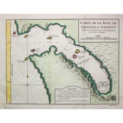
Carte de la Baye de Saldana ou Saldane.
Jaques Nicolas Bellin (1702-720) was the most important French hydrographer of the 18th century. Sea-atlas 'Hydrographique Français' , 1756-65, atlas to accompany Prévo...
Date: Paris, c. 1750
Selling price: ????
Please login to see price!
Sold in 2020
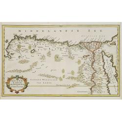
EGYPT an LYBIA.
Map of northern Africa with Egypt, Lybia and Cyrenaica. Nice cartouche at bottom left of map Titled \"EGIPTE,LIBYE,MARMARIKA en CYRENAIKA.\" From the book \&quo...
Date: Amsterdam, ca. 1750
Selling price: ????
Please login to see price!
Sold in 2008
Femmes de Kazegut en differens habits.
The engraving depicts a typical Woman of Kazegut in different costumes, from "Histoire des Voyages.." by Prevost. Below title in Dutch "Vrouwen van Kazegut...
Date: Paris, Didot, ca. 1750
Selling price: ????
Please login to see price!
Sold in 2015
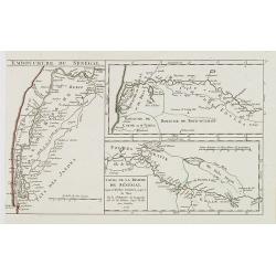
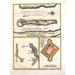
Riviere du Senegal / Isle saint Louis / Petit du Fort St. Joseph.
This 1747 nautical three charts on one page by J.C.Bellin, depicts the Senegal River and the area surrounding Fort St. Joseph & Fort St. Louis. This region was part o...
Date: Paris, 1750
Selling price: ????
Please login to see price!
Sold in 2017
Plan de Fort Dauphin.
A striking plan of the Fort of Dauphin on the southeastern point of Madagascar. It was engraved by J. van Schley and has a fancy decorative title cartouche.
Date: Paris, 1750
Selling price: ????
Please login to see price!
Sold in 2016
Plan de L'Isle et Ville de Quiloa.
Copper engraved plan of the fortified town of Quiloa on the east coast of Africa. This town was the center of the Portuguese slave trade.
Date: Paris, c. 1750
Selling price: ????
Please login to see price!
Sold in 2016
Carte d' l'Egypte ancienne et moderne. . .
Detailed map of the entire Nile Valley from Assouan (Syene) to Damiette from his "Atlas Universel".Gilles Robert de Vaugondy (1688–1766), also known as Le Sie...
Date: Paris, 1750
Selling price: ????
Please login to see price!
Sold in 2015
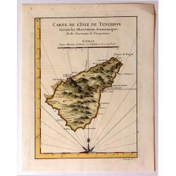
Carte de l'Isle de Teneriffe, Suivant les Observations Astronomiques
A attractive map of the island of Tenerife (Canary Isles) which was produced by Jacques Nicolas Bellin (1703-1772) and published in Prevost's “L'Histoire Générale d...
Date: Paris, 1750
Selling price: ????
Please login to see price!
Sold in 2015
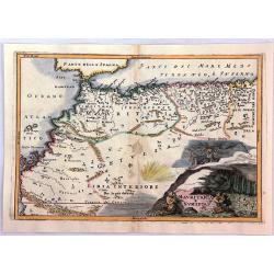
Mauritania E Numidia.
A striking map of the Barbary Coast, or northern Africa in antiquity. The map depicts the ancient empires of Mauritania and Numidia currently known as Morocco and Algeria...
Date: Paris, ca. 1750
Selling price: ????
Please login to see price!
Sold in 2016
A General Map of the River Sanaga or Senegal
A map of the River Sanaga or Senegal on the west coast of Africa, from the falls of Govina to the Ocean. Main map has two insets: 1. Location of Fort St Joseph; Plan of F...
Date: Paris, 1750
Selling price: ????
Please login to see price!
Sold in 2016
Plan du Fort et de la ville du Cap de Bonne Esperance.
Early plan of the city, the fort and Good Hope Cape. Across the top is an extensive list of 22 important sites and locations keyed to the plan with tiny letters and numbe...
Date: Paris, 1750
Selling price: ????
Please login to see price!
Sold in 2017
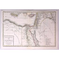
Parte Orientale dell Impero Romano Ossia del Mondo Noto Agl'Antichi.
The eastern part of the Ancient Roman Empire by Anville. It covers the areas of Libya, Egypt and Arabia. Engraved by G. Canrani.Jean Baptiste Bourguignon d'Anville (1697...
Date: Paris, ca. 1750
Selling price: ????
Please login to see price!
Sold in 2017
Plan du Fort Anglois et de la Ville du Cap de Corse.
Cap de Corse or Cape Coast Castle on the Gold Coast in Ghana in Africa was called the "Gate of No Return". Originally a 17th century Swedish trading post, it ul...
Date: Paris, 1750
Selling price: ????
Please login to see price!
Sold in 2018
Carte de la Baye de la Table . . .
Map of La Table Bay. Across the top is an extensive list of 22 important sites and locations keyed to the plan with tiny letters and numbers.Jacques Nicolas Bellin (1703-...
Date: Paris, 1750
Selling price: ????
Please login to see price!
Sold in 2021
Carte des Cotes du Golfe de Guinee.
A detailed map of the Gulf (Bight) of Benin and part of the Guinea coast The map features many place names, including the Slave Coast.Jacques Nicolas Bellin (1703–1772)...
Date: Paris, 1750
Selling price: ????
Please login to see price!
Sold in 2019
Ile Maurice Nommee Depuis Ile De France.
A fine bird's-eye view and view of the harbor of the Ile Maurice, or Mauritius, from Prevost's "Histoire Des Voyages", 1750.The mountains are covered with cloud...
Date: Paris, 1750
Selling price: ????
Please login to see price!
Sold in 2021
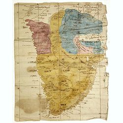
(Cape of Good Hope manuscript map)
Dutch manuscript map of South Africa, with text in Dutch. Showing mountains, rivers, town names and Kingdoms. Fine manuscript map of Southern Africa full of information, ...
Date: Netherlands, ca. 1750
Selling price: ????
Please login to see price!
Sold in 2023
Karte von dem Eilande S.Thomas [together with] Karte von der Bay und Insel von Mozambik. [Manuscrip!]
Fascinating manuscript map of St. Thomas and the Bay of Mozambique, at the mouth of the Zambezi River. The map is a mix of German and Spanish nomenclature. The Mozambique...
Date: Germany, ca. 1750
Selling price: ????
Please login to see price!
Sold in 2020
Carte Particuliere de la Coste d'Or pour servir aux Vaisseaux Du Roy.
An interesting map showing the coasts of Cote d'Ivoire, Guinee, Ghana and more. A fine early sea chart , published by the French Hydrographical Department. This chart was...
Date: Paris, 1750
Selling price: ????
Please login to see price!
Sold in 2020
[Lot of 14 maps] Carte Generale de la Coste de la Guinée. Plus a map of the Gulf of Guinea on 2 sheets by Rigobert Bonne and 6 other maps of the Gulf of Guinea
Jaques Nicolas Bellin (1702-720) was the most important French hydrographer of the 18th century. Sea-atlas 'Hydrographique Français' , 1756-65, atlas to accompany Prévo...
Date: Paris, 1750
Selling price: ????
Please login to see price!
Sold in 2024
[Lot of 7 map / prints of Madagascar] Parte de la Cote Orientale d' Afrique avec l' Isle de Madagascar et les Cartes particulières des Isles de France et de Bourbon.
A map of Madagascar with 2 insets depicting Mauritius and Réunion. and the opposite mainland of Africa, nowadays Mocambique. The area around the Zambesi river, rich in g...
Date: Paris, c. 1750
Selling price: ????
Please login to see price!
Sold in 2022
Pas caert vande cuften van Angola van Rio de Zaire...
This decorative sea chart of Angola features many place names along the coast. In the upper right corner, we see a figurative title cartouche, and in the lower left corn...
Date: Amsterdam, 1751
Selling price: ????
Please login to see price!
Sold in 2016
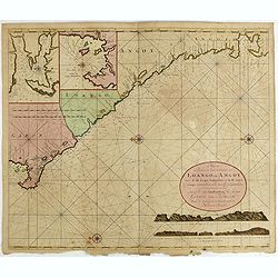
Nieuwe Paskaert van de Custen Zee Loango en Angoy van C. de Lopo Gonzalves tot R. de Zaire os Congo vertoonende alle desselfs gelegenteden.
Sea-chart of the coast of Gabon, Loango, Angoy and Angola to Zaire (Congo) River. In lower right side title and two coastal profiles. In upper left corner inset charts of...
Date: Amsterdam, ca. 1715 -1751
Selling price: ????
Please login to see price!
Sold in 2025
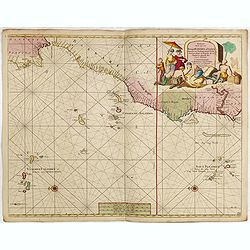
Paskaart van de Cust van Portugal, Barbaria, en Genehoa. Beginnende van d' Barlenges tot aan C. Verde. Met al zyn Diepte en Drooghte dus ver Naaukeurig opgesocht door Ervaren Stuurlieden.
Fine sea chart of the Azores, Canary and Cape Verde island groups that were so important to the Atlantic trade routes. The large pictorial cartouche includes a group of E...
Date: Amsterdam, 1751
Selling price: ????
Please login to see price!
Sold in 2015
Carte particuliere de la Cote Occidentale de l'Afrique...
A large 2 sheet map of a part of the west coast of Africa that covers The Gambia and Senegal.
Date: Paris, ca. 1751
Selling price: ????
Please login to see price!
Sold in 2016
L AFRIQUE Dresse sur les Observations de Mrs de L'academie Royalle des Sciences. . .
A very fine, old color, decorative map of Africa, showing the Mediterranean and south Europe, Madagascar, Azores and Cape Verde. The Atlas was published on behalf of the ...
Date: Paris, 1751
Selling price: ????
Please login to see price!
Sold in 2019
Pascaerte van Rio Gambia Als meede het Vaerwater tussen Cabo Verde en Brazil.
A highly decorative sea chart of the Atlantic Ocean between Gambia, Cap Verde and Brazil. On top is a figurative scale cartouche flanked with putti and in the lower left...
Date: Amsterdam, 1751
Selling price: ????
Please login to see price!
Sold in 2023
Plan du Cap de Bonne-Esperance et ses environs..
Large and detailed sea chart of the Cape of Good Hope from Saldahna Bay to False Bay. Probably from Neptune Oriental, published in 1745. Note that this version differs in...
Date: Paris, 1752
Selling price: ????
Please login to see price!
Sold
Carte de la Phoenicie et des Environs de Damas.
The eastern part of the Ancient Roman Empire by Anville. It covers the areas of Phoenicia around the city of Damas in Egypt Engraved by De La Haye.Jean Baptiste Bourguig...
Date: Paris, 1752
Selling price: ????
Please login to see price!
Sold in 2017
Paskaart van een gedeelte van de Aethiopische=Zee.. Madagascar..
Showing the island of Madagascar and the east coast of Africa. Very rare: included in 6th volume, so-called secret atlas of the V.O.C. of Van Keulen. Latitude scale, comp...
Date: Amsterdam 1753
Selling price: ????
Please login to see price!
Sold
Carte Reduite Des Costes Occidentales D'Afrique Premiere Feuille contenant Les Costes de Barbarie depuis le Detroit de Gibraltar jusqu'au Cap Bojador Et Les Canaries . . . MDCCLIII
A well engraved and highly detailed of the Canary Islands, Madeira, from the Straits of Gibraltar to Cap Bojador, and the coast of Morocco. The chart shows soundings, an...
Date: Paris, 1753
Selling price: ????
Please login to see price!
Sold in 2015
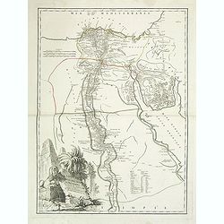
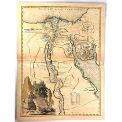
Carte de L'Egypte Ancienne et Moderne. . .
A splendid map of ancient Egypt prepared by R.P.Sicard. From AU 'Préface,' p.31a-b: problem of co-ordinates of Delta: used the observed positions of Alexandra, Peluse, C...
Date: Paris, 1753
Selling price: ????
Please login to see price!
Sold in 2012
Carte Reduite Des Costes Occidentales D'Afrique Premiere Feuille contenant Les Costes de Barbarie depuis le Detroit de Gibraltar jusqu'au Cap Bojador Et Les Canaries . . . MDCCLIII
A well engraved and highly detailed of the Canary Islands, Madeira, from the Straits of Gibraltar to Cap Bojador, and the coast of Morocco. Prepared by Nicolas Bellin. T...
Date: Paris, 1753
Selling price: ????
Please login to see price!
Sold in 2017
Carte de L'Egypte Ancienne et Moderne.
A fine large map of the Nile River valley with superb detail of cities, towns, villages, canals, pyramids, mosques, ruins and more. Across the Red Sea are details of wher...
Date: Paris, 1753
Selling price: ????
Please login to see price!
Sold in 2018
Carte Reduite DES COSTES OCCIDENTALES D' AFRIQUE Second fouille Depuis le Cap Bojador jusqu'a a la Riviere de Sierra Leona...
A beautiful map of the western coast of Africa. The map was published out of Paris by the Department de la Marine in 1765. This scarce sea chart covers the western coast ...
Date: Paris, 1753
Selling price: ????
Please login to see price!
Sold in 2019
Carte Reduite DES COSTES OCCIDENTALES D' AFRIQUE Premiere fouille contenant, Les Costes de Barbarie. . .
A beautiful map of the north western coast of Africa. The map was published out of Paris by the Department de la Marine in 1765. This scarce sea chart covers the north we...
Date: Paris, 1753
Selling price: ????
Please login to see price!
Sold in 2019
Carte De La Coste Occidentale D'Afrique Depuis le XII Dégré de Latitude Septentrionale Jusqu'au XI Dégré de Latitude Meridionale.
Very detailed map of Africa's western coast from Sierra Leone across to the Grain, Ivory, Gold and Slave coasts and Nigeria & the Gulf of Guinea. From thence the coas...
Date: Paris, 1754
Selling price: ????
Please login to see price!
Sold in 2012
Carte des isles du Cap Verd..
This is one of the more detailed maps of the Cape Verde Islands of its time. The major settlements as well as topographical aspects are shown. A decorative wind rose near...
Date: Paris, 1754
Selling price: ????
Please login to see price!
Sold in 2008
Carte Reduite D'Une Partie Des Costes Occidentales et Meridionales De L'Afrique Depuis Cabo Frio ou Cap Froid . . . Jusque a la Bay S. Blaise . . . MDCCLIV [with view of Cape of Good Hope]
Very large and detailed of the southern African coastline from Cape Fria in Namibia to Cape Agulhas. In lower left corner a rococo title cartouche and in top a profile o...
Date: Paris, Dépôt de la Marine, c.1754
Selling price: ????
Please login to see price!
Sold in 2011
2e. Carte D'Afrique.
A map of Africa, engraved by J. Gibson, from Atlas Methodique by Jean Palairet, published by Nourse Vaillant.
Date: London, 1754
Selling price: ????
Please login to see price!
Sold in 2013
Plan du Fort Dauphin, Constuit par les François.
Fine copper engraved, hand colored map of Fort Dauphin on the Island of Madagascar of the east coast of Africa. After N. Bellin and engraved by van Schley. Features a bea...
Date: Paris, 1754
Selling price: ????
Please login to see price!
Sold in 2017
Carte Reduite d'Une Partie Des Costes Occidentales et Meridionales de l'Afrique.
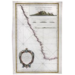
A fine, beautiful colored sea chart of the Southwest Coast of Africa, published by Nicolas Bellin. With three insets showing vies of "Vue du Cap de Bonne Esperance&q...
Date: Paris, 1754
Selling price: ????
Please login to see price!
Sold in 2020
Carte de la Baye de la Table et Rade du Cap de Bonne Esperance. . .
A detailed map of the Table Bay and Robben Island at Cape Town, South Africa, extending north to Mountain Blue. Engraved by van der Schley.Jacques Nicolas Bellin (1703–...
Date: Paris, 1754
Selling price: ????
Please login to see price!
Sold in 2020
Carte de la Coste d' Angola Depuis la Riviere de Bengo jusqu'a Quanza.
Jaques Nicolas Bellin (1702-720) was the most important French hydrographer of the 18th century. Sea-atlas 'Hydrographique Français' , 1756-65, atlas to accompany Prévo...
Date: Paris, c. 1755
Selling price: ????
Please login to see price!
Sold in 2018
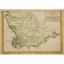
Le Pays des Hottentots.
Jaques Nicolas Bellin (1702-720) was the most important French hydrographer of the 18th century. Sea-atlas 'Hydrographique Français' , 1756-65, atlas to accompany Prévo...
Date: Paris, c. 1755
Selling price: ????
Please login to see price!
Sold in 2018


![[2 prints] Cadaver balsamo conditum... / Loculi Conspectus anterior auctior...](/uploads/cache/82536-250x250.jpg)










![[2 sheet wall map] Afrique publiée sous les auspices de Monseigneur le Duc d'Orléans Prémier Prince du Sang..](/uploads/cache/39670-250x250.jpg)









![Karte von dem Eilande S.Thomas [together with] Karte von der Bay und Insel von Mozambik. [Manuscrip!]](/uploads/cache/45281-250x250.jpg)

![[Lot of 14 maps] Carte Generale de la Coste de la Guinée. Plus a map of the Gulf of Guinea on 2 sheets by Rigobert Bonne and 6 other maps of the Gulf of Guinea](/uploads/cache/18246-250x250.jpg)
![[Lot of 7 map / prints of Madagascar] Parte de la Cote Orientale d' Afrique avec l' Isle de Madagascar et les Cartes particulières des Isles de France et de Bourbon.](/uploads/cache/18022-(1)-250x250.jpg)






![Carte Reduite D'Une Partie Des Costes Occidentales et Meridionales De L'Afrique Depuis Cabo Frio ou Cap Froid . . . Jusque a la Bay S. Blaise . . . MDCCLIV [with view of Cape of Good Hope]](/uploads/cache/31261-250x250.jpg)


