Browse Listings in Africa
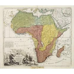
L'Afrique Dressée selon les derniners relat et suivant les nouvelles decouvertes...?
Striking copper plate engraved map of all of Africa from the 'Atlas Curieux' of Nicholas de Fer (1646-1720). Tooley p.45, plate 33, third state with the date 1717. Curiou...
Date: Paris, 1717
Selling price: ????
Please login to see price!
Sold
L'Afrique Dressée selon les dernieres relat. et suivant . . .
Map of Africa. Decorative dedication panel and title cartouche.
Date: Paris, 1717
Selling price: ????
Please login to see price!
Sold in 2009
Vue et description des Forts Que Les Hollandois, Anglois, et Danois ont sur la cote de Guinee.
Decorative, copperplate sheet with 12 vies of African Cities, from Chatelain's monumental 7 volume Atlas Historique.Includes a series of views showing Map shows on 12 vie...
Date: Paris 1717
Selling price: ????
Please login to see price!
Sold in 2019
Nouvelle carte de l'Afrique avec des remarques et des tables pour trouver sans peine les differents peuples de cette partie du Monde par les Renvois Alphabetiques suivant les plus nouvelles ...
Nouvelle carte de l'Afrique avec des remarques et des tables pour trouver sans peine les differents peuples de cette partie du Monde par les Renvois Alphabetiques suivant...
Date: Amsterdam, 1718
Selling price: ????
Please login to see price!
Sold in 2008
Nouvelle carte de l'Afrique avec des remarques et des tables pour trouver sans peine les differents peuples de cette partie du Monde par les Renvois Alphabetiques suivant les plus nouvelles Observations de Messieurs de l'Academie des Siences.
Decorative map of Africa, with text borders on both sides. The map is based on Delisle's landmark map of Africa (1700), which was the first to present a non-Ptolemaic ver...
Date: Amsterdam, 1718
Selling price: ????
Please login to see price!
Sold in 2017
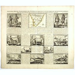
Coutumes, Moeurs et Habillemens des Peuples qui Habitent aux Environs du Cap de Bonne Esperance..
Decorative images of people & animals, with a map of southern Africa after Tachard. The people depicted are the Hottentots and the Namaquas of the Cape of Good Hope. ...
Date: Amsterdam, c. 1719
Selling price: ????
Please login to see price!
Sold in 2008
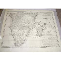
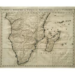
Carte du Royaume de Congo, du Monomotapa et de la Cafrerie.
A detailed map of Southern Africa. Effectively De Lisle map of 1708, this is the French version by Chatelain,with a text block at lower right describing the Congo, Monomo...
Date: Amsterdam, c.1719
Selling price: ????
Please login to see price!
Sold
Royaumes de Congo et d'Angola.
Pieter van der Aa was a prolific publisher. He published a.o. ' Naauwkeurge versameling der gedenkwaardigste zee- en land-reysen', a series of accounts of voyages (1706-0...
Date: Leiden, 1719
Selling price: ????
Please login to see price!
Sold
L' Afrique Dressee suivant les Auteurs les plus nouvea..
Charming map of the African continent with some interesting cartography and filled with notations.The Nile is correctly shown with its origins in Abyssinia. A large Lac d...
Date: Paris 1719
Selling price: ????
Please login to see price!
Sold
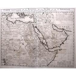
Carte Particuliere de L'Egypte, de l Nubie et de L'Abbisinie.
This (large) beautiful map is based on the work of the important French cartographer Guillaume Delisle. It is a very detailed and fascinating view of northeastern Africa,...
Date: Amsterdam, 1719
Selling price: ????
Please login to see price!
Sold in 2016
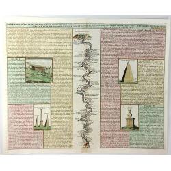
Description du Nil de Ses Sources de Son Cours Depuis les Cataractes Jusques au Caire ....
A fine folio engraving centred on the river Nile (with north at the bottom), stretching from the 1st cataract at Aswan to Cairo with accompanying text in French. On eithe...
Date: Amsterdam, 1719
Selling price: ????
Please login to see price!
Sold in 2021
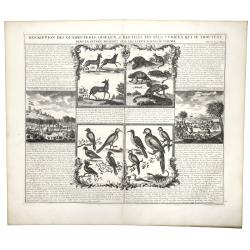
DESCRIPTION DES QUADRUPEDES, OISEAUX & REPTILES LES PLUS CURIEUX QUI SE TROUVENT DANS LA GUINEE . . .
A decorative copperplate engraving showing quadrupeds, reptiles and the birds of Guinea, including a scene with elephants, from Henri Chatelain's monumental 7 volume &quo...
Date: Amsterdam, 1719
Selling price: ????
Please login to see price!
Sold in 2019
COUTUMES MOEURS & HABILLEMENS des PEUPLES QUI HABITENT AU ENVIRONS DU CAP DE BONNE ESPERANCE. . .
A decorative image of people & animals, with a map of southern Africa after Tachard. The people depicted are the Hottentots and the Namaquas of the Cape of Good Hope....
Date: Amsterdam, ca 1719
Selling price: ????
Please login to see price!
Sold in 2019
Carte Du Royaume De Congo Du Monomotapa et de la Cafrerie.
A copper engraved, detailed map of South Africa and Madagascar, with extensive notes regarding the local tribes, geography, mines, rivers, mountains, etc. One of the most...
Date: Amsterdam, ca 1719
Selling price: ????
Please login to see price!
Sold in 2019
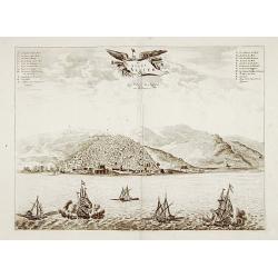
De stadt Algier.
Rare panoramic view of Algiers in Algeria.Printed by Covens and Mortier, who used the plates originally engraved for Montanus. Uncommon issue.
Date: Amsterdam 1720
Selling price: ????
Please login to see price!
Sold
Carte generale de L'Afrique, levée par ordre expres des roys de Portugal..
An impressive chart of the continent of Africa. Decorative scale cartouche to the lower left and the eastern tip of Brazil.
Date: Amsterdam, 1720
Selling price: ????
Please login to see price!
Sold in 2012
L'Afrique.
Print depicting natives from Africa with lions and elephants.
Date: Paris, 1690-1720
Selling price: ????
Please login to see price!
Sold
L'Afrique dressée sur les observations de M. de l'academie Royale des Sciences..
Very fine engraved map of Africa with a very decorative title cartouche. Giving good detail along the coast.An version printed in Amsterdam after De L'Isle.
Date: Amsterdam 1720
Selling price: ????
Please login to see price!
Sold
Carte particuliere de L'Isle Dauphine ou Madagascar..
An impressive large sheet of the island of Madagascar. Numerous place names, soundings and sand banks are shown round the island and the regions are defined in original ...
Date: Amsterdam 1720
Selling price: ????
Please login to see price!
Sold in 2012
Totius Africae nova repraesentatio..
Richly ornamented map of Africa and the Arabia Peninsula. With an extraordinary delineation of the Nile which is based partly on Ptolemy (rising in two large lakes, Zaire...
Date: Nuremberg 1720
Selling price: ????
Please login to see price!
Sold
Africa Vetus.
Map of ancient Africa, with the geographical features known to the ancients and decorated with a vignetter and 23 Roman coins & medallions. A interesting and highly d...
Date: Nuremberg, 1720
Selling price: ????
Please login to see price!
Sold
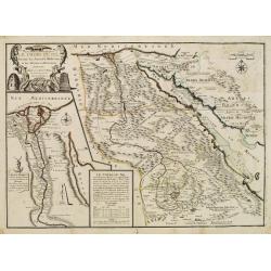
Le Cours Du Nil, Suivant Les Auteurs Modernes et les dernieres Relations.
Two maps on one sheet: a general depiction of the Nile Valley and Egypt, and a smaller map focusing on the delta region with detail of ancient civilization.
Date: Paris, 1720
Selling price: ????
Please login to see price!
Sold
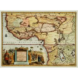
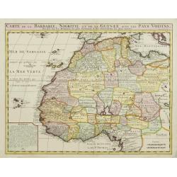
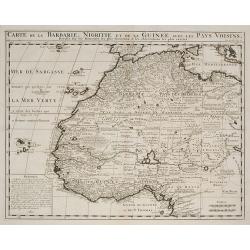
Carte de la Barbarie, Nigritie, et de la Guinée?
Map of North and West Africa, including the Canary Islands, the Cape Verde Islands and the Azores. According to the title "drawn up from early 18th century reports a...
Date: Amsterdam, ca. 1720
Selling price: ????
Please login to see price!
Sold
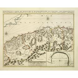
Nouvelle carte du Roiaume D\'Alger divisée en toutes ses provinces, avec une partie due cotes D\'Espagne . . .
Rare and detailed map of the coast of Algeria. Large inset map of the Bay of Alger (El-Jazir). Shows a coastline of Spain around Alicante. Two compass roses in the Medite...
Date: Amsterdam, 1720
Selling price: ????
Please login to see price!
Sold in 2012
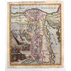
Aegyptus Hodierna.
Highly decorative map depicting the Nile River. Large vignette featuring the pyramids, Sphinx, tombs of the kings and waterfall. Johann Baptist Homann (1664 – 1724) wa...
Date: Nuremberg, 1720
Selling price: ????
Please login to see price!
Sold in 2013
Africa --- mauro percussa Oceano, Niloque admota tepenti....Cum Privilegio ordinum Hollandia et Westfrisia.
An attractive map of Africa containing many of the striking characteristics of Dutch cartography of Africa from around this period. The cartouche in this map is the same...
Date: Amsterdam, c. 1720
Selling price: ????
Please login to see price!
Sold in 2013
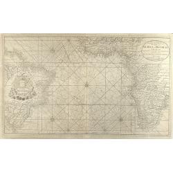
Nieuwe Wassende Graadige Pas-kaart van de Kust van Guinea en Brasilia strekkende van Cap-Verde tot de Cap de Bon-Esperance en Verders van Rio de Berbice tot Rio de la Plata te Amsterdam by Joannes van Keulen
Very large scale sea chart of the Atlanic Ocean from J. van Keulen. Showing the west coast of Africa down to South Africa and Brasil in the West. Exceptional for a nautic...
Date: Amsterdam, 1720
Selling price: ????
Please login to see price!
Sold in 2008
Aegyptus Antiqua Divisa in Nomos.
Very interesting copper engraved map of Northern Egypt and parts of Lybia, showing the are from the Mediterranean Sea with the Nile delta and Alexandria, to the Red Sea, ...
Date: Amsterdam, c1720
Selling price: ????
Please login to see price!
Sold in 2011
Carte de la Barbarie, Nigritie, et de la Guinée ?
Map of North and West Africa, including the Canary Islands, the Cape Verde Islands and the Azores. According to the title "drawn up from early 18th century reports a...
Date: Amsterdam, ca. 1720
Selling price: ????
Please login to see price!
Sold in 2009
Guinea.
An attractive map, covering the coast from Sierra Leone to Gabon, filed with intersecting rhumb lines and decorated with monkeys, lions, elephants, sea monsters and two c...
Date: Amsterdam, 1720
Selling price: ????
Please login to see price!
Sold in 2009
Jobi Ludolfi Habessinia seu Abassia Presbyteri Johannis ?
Jobi Ludolfus (1624-1704) was a German scholar and historian, specialising in Abyssinia (Ethiopia). His map is one of the earliest, relatively accurate maps of the region...
Date: Amsterdam, 1720
Selling price: ????
Please login to see price!
Sold in 2010
To the Right Honourable Charles, Earl of Peterborow, and Monmouth, &c. This Map of Africa
Herman's Moll's magnificently detailed large scale map of Africa, one of the finest and probably most decorative depictions of the continent made in the eighteenth-centur...
Date: London, c1720
Selling price: ????
Please login to see price!
Sold in 2011
Dracht en Wapening der Hottentots.
Large format view of "Hottentots" in traditional clothing and armed with spear and bow. Located at the Cape of Good Hope. Title below the view: "Les Armes ...
Date: Leiden, c1720
Selling price: ????
Please login to see price!
Sold in 2013
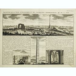
Description de la Ville d'Alexandrie et des Antiquites Remarquables qu'on y voit.
Panoramic view of the ancient Egyptian port city of Alexandria accompanied by insets of "Palais de Cleopatre" (the ruins of Cleopatra's palace), Obelisque d'Ale...
Date: Amsterdam, 1720
Selling price: ????
Please login to see price!
Sold in 2016
Africae emendata Descriptio.
Very interesting map of Africa, including Arabia, Persia, the Maledives, and a small part of Brazil. With many details and place names. Also a "Terra Incognita"...
Date: Nuremberg, ca. 1720
Selling price: ????
Please login to see price!
Sold in 2015
Pas caarte van de Bocht van Gabon Tusschen C. Formose en C. de Lopo Gansalves. . .
This map depicts the west coast of Gabon from Cape Formosa to Cape de Lopo, with the islands of St. Thomas and Principi.
Date: Amsterdam, 1720
Selling price: ????
Please login to see price!
Sold in 2016
Royaumes de Congo et d'Angola...
Scarce regional map centered on the Zaire river. Extends from about Port Gentil to Lobito. With several place names mainly along the Congo River. With a very large title ...
Date: Leiden, 1720
Selling price: ????
Please login to see price!
Sold in 2018
Singularitez Curieuses des Royaumes de Maroc et de Fez dans la Barbarie . . .
In the top a map of the Barbary Coast entitled La Barbarie. The text in the center of the sheet describes the Kingdoms of Morocco and Fez. The panel is bordered with thei...
Date: Amsterdam, 1720
Selling price: ????
Please login to see price!
Sold in 2023
Description Du Nil de ses Sources, De Son Cours Depuis Les Cataractes Jusques Au Caire,...
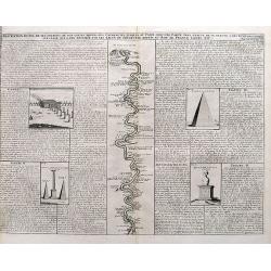
A detailed map of the course of the Nile River, from the cataracts of the Nile at the south (top of the image) to Cairo and Giza. Shows one of the Pyramids (1400 feet tal...
Date: Amsterdam, ca. 1720
Selling price: ????
Please login to see price!
Sold in 2017
Description des Piramides d'Egypte...
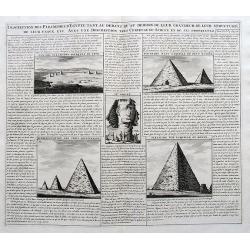
An interesting sheet with four views of the Pyramids of Giza and one image of the Sphinx. With extensive descriptive text in French.
Date: Amsterdam, ca. 1720
Selling price: ????
Please login to see price!
Sold in 2017
Description Des Quadrupedes, Oiseaux & Reptiles Les Plus Curieux Qui Se Trouvent Dans La Guinee . . .
Decorative copperplate engraving showing quadrupeds, reptiles and birds of Guinea, including a scene with elephants. From Chatelain's monumental 7 volume "Atlas Hist...
Date: Amsterdam, 1720
Selling price: ????
Please login to see price!
Sold in 2022
Description de la Ville d'Alexandrie et des Antiquites Remarquables qu'on y voit.
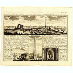
Panoramic view of the ancient Egyptian port city of Alexandria accompanied by insets of "Palais de Cleopatre" (the ruins of Cleopatra's palace), Obelisque d'Ale...
Date: Amsterdam, 1720
Selling price: ????
Please login to see price!
Sold in 2019
Succession des Rois d'Egipte selon leurs diverses races.
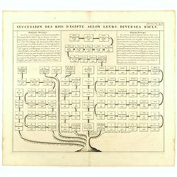
Genealogical tree, showing the Kings of Egypt.Zacharie Chatelain (d.1723) was the father of Henri Abraham (1684-1743) and Zacharie Junior (1690-1754).They worked as a par...
Date: Amsterdam, ca. 1720
Selling price: ????
Please login to see price!
Sold in 2023
Vue & description de la ville de Lovango dans le Royaume de Congo avec plusieurs....
On top a large view of the fabled city of Lovango, text surrounded by ten vignettes of the people and ceremonies of the Kingdom of Congo.Zacharie Chatelain (d.1723) was t...
Date: Amsterdam, 1720
Selling price: ????
Please login to see price!
Sold in 2019
Africa - Maurô percussa Oceanô, Niloque admota tepenti.
A very decorative large format map of Africa by Gerard Valk (1651-1726) and Leonardo Valk (1675-1755) published between 1705-1710. Title in an uncolored yet very ornate c...
Date: Amsterdam, 1720
Selling price: ????
Please login to see price!
Sold in 2020
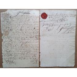
1721 Cape of Good Hope debenture, signed by 4 future COGH Governors, with intact VOC wax seal and 1714 revenue stamp.
This is a fascinating two-page document that needs further research. Written in very readable Dutch, a limited translation reveals that it seems that Jan Spoor (who is ...
Date: Cape of Good Hope, 1721
Selling price: ????
Please login to see price!
Sold in 2015
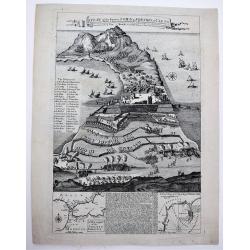
A Plan of the Famous Town & Fortress of Ceuta, Besieg'd by the Moors in 1693 & raid by ye Spaniards after 26 Years Siege in 1720. . .
A very rare separately published broad sheet map of Ceuta, with two insets of Gibraltar and explanatory text, as well as 29 keys, explaining the various strongholds and i...
Date: London, 1721
Selling price: ????
Please login to see price!
Sold in 2020
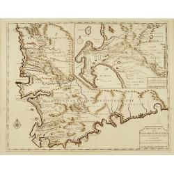
Nieuwe Kaart van Caap der Goede Hoop..
"Fine chart depicting the southern tip of Africa. Little interior detail is given but the coastlines, settlements and principal coastal features are identified. An a...
Date: Amsterdam 1724
Selling price: ????
Please login to see price!
Sold
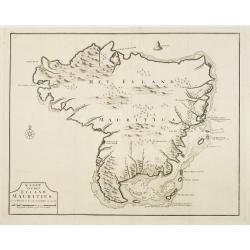
Kaart van het eyland Mauritius.
Fine map depicting the island of Mauritius. Little interior detail is given but the coastlines, settlements and principal coastal features are identified. An attractive e...
Date: Amsterdam 1724
Selling price: ????
Please login to see price!
Sold
Nieuwe Kaart van Caap der Goede Hoop in hare rechte jegenwoordige staat. . .
Fine map depicting the southern tip of Africa. Little interior detail is given but the coastlines, settlements and principal coastal features are identified. In top right...
Date: Amsterdam, 1724
Selling price: ????
Please login to see price!
Sold in 2015
Nieuw Kaart van Caap Der Goede Hoop - in hare rechte jegenwoordige staat vertoond door FRANÇOIS VALENTYN.
An attractive & detailed map of the Cape region, one of the few early Dutch maps to focus on the region only some 70 years after the first Dutch settlement. Area cove...
Date: Amsterdam, 1724
Selling price: ????
Please login to see price!
Sold in 2019
St Helene.
Uncommon small map of St. Helena, with two coastal profile inset maps.From the French reissue of the account of early Dutch voyages first published in 1608 by Commelin. T...
Date: Amsterdam, F. Bernard, 1725
Selling price: ????
Please login to see price!
Sold in 2019
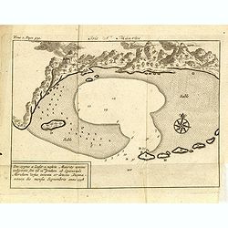
Isle St. Maurice. Ins. cygnae a Lusit, a nostris Maurity nomine indigitata, sita ad 21um gradum ab Equinoctiali Meridiem versus inventa et detecta Decima-jctava die mensis septembris anno 1598.
A bay at ST. Mauritius, a small island located in the South-West Indian Ocean, off the east coast of Madagascar. Mauritius is well known for the Dodo, the extinct bird. T...
Date: Amsterdam, F. Bernard, 1725
Selling price: ????
Please login to see price!
Sold in 2019
Isle St. Hélène.
This bird's eye view shows the Island of Saint Helena in the South Atlantic Ocean. With decorative title cartouche, legend / key, compass rose and ships.This plate origin...
Date: Leiden, ca. 1725
Selling price: ????
Please login to see price!
Sold in 2020
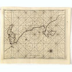
No title: Baya de Saldanha/ Cabo de Boa Esperanca.
Chart of the coast from Saldanha Bay to False Bay, the edge of the land rolled back to show the coast line in silhouette with a scale of miles and compass-rose. Marks Das...
Date: Amsterdam 1726
Selling price: ????
Please login to see price!
Sold
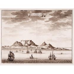
Geziet van Kaap der Goede Hope als men op de Reede legt.
Decorative panoramic view of the Cape of Good Hope with European vessels in the foreground.François Valentijn (1666-1727), a missionary, worked at Amboina from 1684 to 1...
Date: Amsterdam 1726
Selling price: ????
Please login to see price!
Sold
Cape of Good Hope [no title]
"Plan of Cape of Good Hope with the Dutch settlements.Françcois Valentijn (1666-1727), a missionary, worked at Amboina from 1684 to 1694 and 1705 to 1713 and travel...
Date: Amsterdam 1726
Selling price: ????
Please login to see price!
Sold
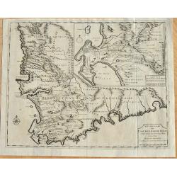
Nieuwe Kaart van Caap de Goede Hoop in hare rechte jegenwoordige staat...
Two maps of Cape of Good Hope. . Windmills and churches are indicated on the bottom map. With inset identifying the first farm layouts, and who the farms belonged to, i...
Date: Amsterdam, 1726
Selling price: ????
Please login to see price!
Sold in 2008
(Cabo de boa esperanca)
Chart of the Cape of Good Hope coast from Saldanha Bay to False Bay, the edge of the land rolled back to show the coast line in silhouette with a scale of miles and compa...
Date: Amsterdam, 1726
Selling price: ????
Please login to see price!
Sold in 2016
Cape of Good Hope [no title]
Plan of Cape of Good Hope with the Dutch settlements. A lettered key in lower right corner.François Valentijn (1666-1727), a missionary, worked at Amboina from 1684 to 1...
Date: Amsterdam, 1726
Selling price: ????
Please login to see price!
Sold in 2015
Kaart van het eyland Mauritius. . .
Fine map depicting the island of Mauritius. Little interior detail is given but the coastlines, settlements and principal coastal features are identified. An attractive e...
Date: Amsterdam, 1726
Selling price: ????
Please login to see price!
Sold in 2015
Gezicht van Kaap Der Goede Hope als men op de Reede legt.
Decorative panoramic view of the town of Samboupo on the island of Celebes (Sulawesi) in today's Indonesia. Dutch (V.O.C.) sailing ships and various local craft fill the ...
Date: Amsterdam, 1726
Selling price: ????
Please login to see price!
Sold in 2017
Carte de l'Afrique Françoise ou du Senegal.
De L'Isle's highly detailed map of part of the West Coast of Africa, from Cap Blanc to the Pays des Mallus, centered on the Gambia River and Senegal River. Good detail al...
Date: Paris, 1726
Selling price: ????
Please login to see price!
Sold in 2020
Nieuwe Paskaart vant Naauw van de Straat. op gedragen aan den Hoog Edel geboren Heer F. Van Aerssen Van Sommelsduk
This is a scarce and well designed sea chart of the Strait of Gibraltar, oriented east with Spain on the left and the Barbary Coast (present-day Morocco) on the right. Th...
Date: Amsterdam 1726
Selling price: ????
Please login to see price!
Sold in 2023
In Notitiam Ecclesiasticam Africae...
A finely engraved map of the northern coast of Africa and western Mediterranean sea, including southern Europe. The African portion of the work offers exceptional detail,...
Date: Amsterdam, ca. 1727
Selling price: ????
Please login to see price!
Sold
Carte de La Barbarie de La Nigritie et de Guinee.
A detailed engraved map of north west Africa including the Canary and Cape Verde Islands. The title is displayed along the top of the map. A rare re-issue of De l'Isles m...
Date: Amsterdam, 1727
Selling price: ????
Please login to see price!
Sold in 2012
Caarte van de beyde afgelegenste colonien Drakensteen en Waveren...
Fine and early map of Colonies of Drakenstein in South Africa, from Kolbe's "Naukeurige en Uitvoerige beschryving van de Kaap de Goede Hoop".
Date: Amsterdam, 1727
Selling price: ????
Please login to see price!
Sold in 2015
Africa Juxta Navigationes et Observationes Recentissimas?
Large, very graphic map of the continent with a large pictorial title cartouche containing native figures, animals, the pyramids and a fierce dragon. The misconceptions a...
Date: Augsburg, c. 1728
Selling price: ????
Please login to see price!
Sold
Le Cap de Bonne Esperance, suivant les nouvelles observations..
Uncommon edition of this map of the Cape of Good Hope. With decorative title cartouche lower left corner.This example is unusual in having the additional separately engra...
Date: Amsterdam 1728
Selling price: ????
Please login to see price!
Sold in 2009
Nigritie, ou le Pays des Negres, en Afrique...
Map of West Africa. With beautiful title cartouche.
Date: Leiden , c.1728
Selling price: ????
Please login to see price!
Sold
Statuum Marocca Norum.
Large and very graphic map by the preeminent German cartographer. The map itself is very detailed showing the domains of desert tribes by means of little tent cities. It ...
Date: Nuremberg 1728
Selling price: ????
Please login to see price!
Sold
Le Cap de Bonne Esperance, suivant les nouvelles observations..
This is a small detailed map of the Cape from Saldanha to False Bay. The attractive title cartouche on the lower left is on a stone pediment surmounted by a lion and lion...
Date: Amsterdam 1728
Selling price: ????
Please login to see price!
Sold
Habillemens des Arabes & des Juifs qui sont au Caire avec..
An interesting sheet from Volume Six of Chatelain's Atlas Historique containing a description of "The dress of the Arabs and Jews residing in Cairo with part of thei...
Date: Amsterdam 1728
Selling price: ????
Please login to see price!
Sold
Statuum Marocca Norum.
Large and very graphic map by the prominent German cartographer. The map itself is very detailed showing the domains of desert tribes by means of little tent cities. It e...
Date: Nuremberg, 1728
Selling price: ????
Please login to see price!
Sold
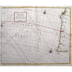
A New and Correct Chart of the Coast of Africa from Cape Negro to Cape Bona Esperance.
A rare sea chart showing a part of South Africa including the Cape of Good Hope and Table Bay. Extends to locate Tristan da Cunha and St. Helena! Published in the Atlas...
Date: London, 1728
Selling price: ????
Please login to see price!
Sold in 2016
Vue de Tunis D Alger &c de Gigeri avec Quelques Particularitez Curieuses . . .
The plate is bordered by series of views with views and people of present-day Algeria. On top a view of Algiers, a funeral and how they executed criminals. On the bottom ...
Date: Amsterdam, 1728
Selling price: ????
Please login to see price!
Sold in 2017
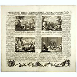
Description des cases ou habitations des negres, de celles du Roi d'Issiny . . .
Four engravings on one sheet showing native live in Africa, including warriors, a leopard, the manner of gathering food from palm trees and the interior of a typical nati...
Date: Amsterdam, ca. 1728
Selling price: ????
Please login to see price!
Sold in 2020
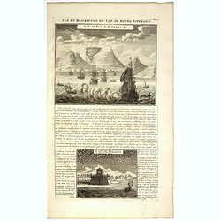
Vue et Description du Cap de Bonne Espérance.
In top copperplate engraving of the Cape with shipping in the foreground flying the Dutch flag, with engraved descriptive text between the two views, mainly concerning th...
Date: Amsterdam, 1728
Selling price: ????
Please login to see price!
Sold in 2017
Coutumes Moeur & Habillemens..du Cap de Bonne Esperance..
In top a small map of Southern Africa (100 x 120 mm.) and 10 engravings of natives and animals of Southern Africa. In top an unusual map of Africa almost identical to tha...
Date: Amsterdam, 1728
Selling price: ????
Please login to see price!
Sold in 2018
Africa Iuxta Navigationes et Observationes Recentissimas Aucta Correcta et in Sua Regna et Status Divisa, in Lucem Edita.
A beautifully hand colored and very detailed map of Africa, with a fine dark impression. The map is typical of the period with the information in southern Africa being la...
Date: Vienna, 1728
Selling price: ????
Please login to see price!
Sold in 2019





















![Cape of Good Hope [no title]](/uploads/cache/15932-250x250.jpg)
![Cape of Good Hope [no title]](/uploads/cache/35902-250x250.jpg)


