Browse Listings in Europe > Germany > German Provinces
Nova Totius Westphaliae descriptio.
Map of the northern provinces of Germany, including the Wad islands. West to the top. Including Bremen, Hildesheim, Kassel, Düsseldorf, etc. Also including the Dutch pro...
Date: Amsterdam, 1680
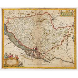
Tabula Geographica Novissima Ducatus Stormariae in Meridionali Parte Holsatiae.
A rare and beautiful map of the region of Germany around Hamburg. Fine detailed topography, including roads, fortifications, cities and villages. The title cartouche is s...
Date: Amsterdam, 1681
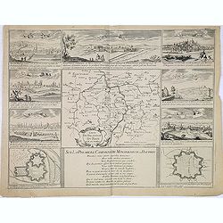
Carte du Palatinat du Rhin.
Decorative "carte à figures"- map centered on Koblenz, Metz, Strasburg, Manheim and Heidelberg, with the river Rhine by François Jollain (ca. 1641 – 18 Apri...
Date: Paris, ca. 1688
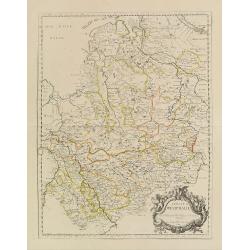
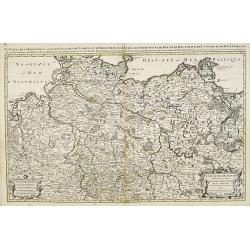
Cercle de Westphalie.
Fine map of Westphalia. The address is much re-worked, now with the address Chez L'Autheur aux Galleries du Louvre , dated 1690.This edition carries the date 1690 and the...
- $100 / ≈ €85
Date: Paris 1690
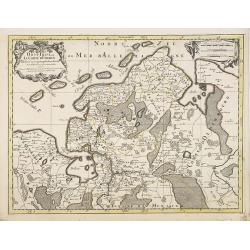
Oost-Frise, ou Le Comté d'Embden . . .
Fine map of East Friesland with a decorative cartouche and small scale of miles.Alexis-Hubert Jaillot (1632-1712), was a French cartographer. He joined the Sanson heirs a...
Date: Amsterdam, 1692
Le Cercle de Westphalie . . .
Fine map of the Westphalia Duchy with a decorative cartouche and small scale of miles.Alexis-Hubert Jaillot (1632-1712), was a French cartographer. He joined the Sanson...
- $150 / ≈ €128
Date: Amsterdam, 1692
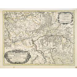
Partie Occidentale du Temporel de l'Archevesché et Eslectorat de Mayence . . .
Fine map of area around Mainz and Frankfurt, decorated with two decorative title and scale cartouches.Alexis-Hubert Jaillot (1632-1712), was a French cartographer. He joi...
- $150 / ≈ €128
Date: Amsterdam, 1692
Le Duché de Westphalie . . .
Fine map of the Westphalia Duchy with the River Ruhr, Decorative title and scale cartouche.Alexis-Hubert Jaillot (1632-1712), was a French cartographer. He joined the S...
- $150 / ≈ €128
Date: Amsterdam, 1692
Le marquisat et electorat de Brandebourg
Fine map of Brandenburg with a decorative title and scale cartouche.Alexis-Hubert Jaillot (1632-1712), was a French cartographer. He joined the Sanson heirs and redrew Ni...
- $100 / ≈ €85
Date: Amsterdam, 1692
Le cercle de la haute saxe ou sont compris le duche et electorat de Saxe. . .
Fine map of Saxe with a decorative title and scale cartouche.Alexis-Hubert Jaillot (1632-1712), was a French cartographer. He joined the Sanson heirs and redrew Nicolas S...
- $250 / ≈ €213
Date: Amsterdam, 1692
Das Bisthum Wurtzburg in Francken.
Rare map of Würzburg. With inset panoramic views of Würzburg and Köningshofen.The map is painted in strong colors. Clearly from an show-piece atlas produced for a weal...
Date: Nurenberg 1698
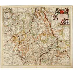
Tabula Episcopatuum Leodiensis et Coloniensis. . .
Rare issue of Cornelis Danckert's attractive map of Limburg, shows the area of Cologne, Mainz, Trier, Jülich, Mons, Antwerp and Liege in Belgium.Decorative title cartouc...
Date: Amsterdam, 1700
Le cercle de la Basse Saxe subdivisé en touts les estats et principautés qui le composant . . .
It is a very large map centered on the river Elbe and following the coastlines of the Baltic Sea up to the Polish border. The map is fully and richly engraved. Large and ...
- $200 / ≈ €170
Date: Amsterdam, c.1705
Partie Méridionale de l'Archevesché et Eslectorat de Cologne. . .
Fine map of the Westphalia, the area in-between the Rivers Maas and Rhine.
- $50 / ≈ €43
Date: Paris, 1707
Principatus Isenacensis cum adjacentibus. . .
Detailed map centered on Gotha and Erfurt. Lower right splendid title cartouche.The map is painted in strong colors. Clearly from an show-piece atlas produced for a wealt...
- $200 / ≈ €170
Date: Nurenberg, 1710
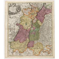
Landgraviatus Alsatiae tam superioris..
Alsace, in the far north-eastern corner of France, stands out from other French wine regions thanks to its strong Franco-Germanic influences. Alsace is the only French wi...
Date: Nurenberg, 1710
Geographica descriptio Montani cujusdam districtus in ..
Detailed map including the towns of Thurnau, Bayreuth, Culmbach, etc. With fine panoramic view of Thurnau. Upper left and right splendid title cartouches.The map is paint...
Date: Nurenberg, 1710
(Ochfenfurt, Hall, Bavaria, etc.)
Rare miniature map of Bavaria including the towns of Ochfenfurt, Hall, etc. From "Le theatre De Bellone, Contenant 48. nouvelles Cartes Geographiques, Des Païs-Bas ...
- $60 / ≈ €51
Date: Amsterdam, 1710
(Hildesheim, Munden, Steinbrugge, Grubenhagen, etc.)
Rare miniature map including the towns of Hildesheim, Munden, Steinbrugge, Grubenhagen, etc. From "Le theatre De Bellone, Contenant 48. nouvelles Cartes Geographique...
- $60 / ≈ €51
Date: Amsterdam, 1710
(Schweinfurt, Reineck, Hirschfeld, etc.)
Rare miniature map including the towns of Schweinfurt, Reineck, Hirschfeld, etc. From "Le theatre De Bellone, Contenant 48. nouvelles Cartes Geographiques, Des Païs...
- $60 / ≈ €51
Date: Amsterdam, 1710
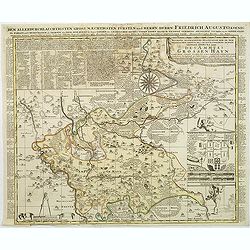
Accurate geographische delineation der in dem Meisnichen creisse des chufurstenthums sachsen liegenden dioeces oder des ammtes grossen hayn
Very detailed map prepared by Adam Frederic Zürner (1680-1742). Surrounded with legends and decorated in the lower right corner with a plan of a royal campement. The tow...
- $90 / ≈ €77
Date: Amsterdam, 1711
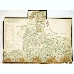
Carte du cours du Rhin dpuis le fort de Schengen jusqu'à Lauterbourg. . .
Beautiful manuscript map of the region around Rastatt and the siege of 1714 signed with the French emperor Charles VI of Habsburg. In top with a small extension of the ma...
Date: Germany, France, c. 1714
Nova et accurata Territorii Ulmensis cum dominio Wainensi..
"Showing the area of Ulm. In the lower part, an inset map of the property"zu Wein". Upper right splendid title cartouche.The map is painted in an intense a...
Date: Nurenberg 1720
Saxoniae Superioris
Impressive title cartouche with miniature panoramic view of Leipzig, coat of arms, putti and Mercury.Johann Baptist Homann born in Kammlach (1663). He was engraver, map-s...
- $150 / ≈ €128
Date: Augsburg, 1720
Nassovia Principatus Cum omnibus ei pertinentibus Comitatibus Dominiis ac Praefecturis ut et Confiniis intra Lahnun, Rhenum, et Moenum Flumina, ad situm verum exacte delineatus a Joh. Jac. Stetter. U.J.L. Idstenio-Nassovio . . .
Decorative map of the area between the rivers Rhine and Meuse, including Mainz, Koblenz, Frankfurt, Saarbrucken, etc.Includes an elaborate cartouche and coat of arms.The ...
- $150 / ≈ €128
Date: Amsterdam, 1720
Le Duché de Lunebourg, suivant les nouvelles observations?
Uncommon edition of this map of a province of Germany. With decorative title cartouche upper right corner.This example is unusual in having the additional separately engr...
- $80 / ≈ €68
Date: Amsterdam, 1728
Cercle de la Basse Saxe, suivant les nouvelles observations..
Uncommon edition of this map of a province of Germany, including Hamburg, Bremen, etc. With decorative title cartouche lower right corner.This example is unusual in havin...
- $90 / ≈ €77
Date: Amsterdam 1728
La Souabe meridionale, suivant les nouvelles observations..
Uncommon edition of this map of Southern Germany. With decorative title cartouche lower right corner.This example is unusual in having the additional separately engraved ...
- $90 / ≈ €77
Date: Amsterdam 1728
L'Archeveché de Mayence, suivant les nouvelles observations..
With decorative title cartouche lower left corner. Including river Rhine. This example is unusual in having the additional separately engraved decorative framework border...
- $100 / ≈ €85
Date: Amsterdam, 1728
Landgraviat de Hesse, suivant les nouvelles observations..
With decorative title cartouche lower right corner.This example is unusual in having the additional separately engraved decorative framework border around the map, the re...
- $90 / ≈ €77
Date: Amsterdam 1728
Nova et Accurata Ducatus Cliviae et Comitatus Marchiae.
With an elaborate -uncolored- title cartouche.
Date: Augsburg, 1728
Praefectura Lipsiencis. . .
Detailed map centered around Leipzig with large pictorial cartouche and smaller cartouche of explanations. Alphabetical list of place names down both sides.
- $150 / ≈ €128
Date: Augsburg, 1730
Nova Territorii Erfordien in suas praefecturas..
"Showing the area of Erfurt. In the lower part, there is a panoramic view of the town. Lower left and right splendid cartouches.The cartouches are painted in a stron...
Date: Nurenberg, 1740
Circulus Saxoniae inferioris.
Detailed map of Saxen, including Bremen, Berlin, Lübeck, etc. Johann Baptist Homann (1663-1724) was a German engraver and publisher, who established himself and his fami...
- $200 / ≈ €170
Date: Nuremberg 1740
Ducatus Magdeburgensis Et Halensis cum finitimis Delineatio geographica. . .
Very decorative map centered on Magdeburg with Elbe river. With a key to the left and right of the map.
- $75 / ≈ €64
Date: Augsburg, ca. 1740
Delineatio geographica praefecturarum Wittebergensis et Graefenhaynichen; in circulo electorali sitarum. . .
Very decorative map of Mansfeld Land, a region in the southwestern corner of the German state of Saxony-Anhalt. The region derives its name from the counts of Mansfeld, w...
- $75 / ≈ €64
Date: Augsburg, ca. 1740
Delineatio geographica praefecturarum Wittebergensis, et Graefenhaynichen. . .
Showing Amt Wittenberge with the river Elbe. Wittenberge is a town of eighteen thousand people on the middle Elbe in the district of Prignitz, Brandenburg.
- $75 / ≈ €64
Date: Augsburg, 1740
Delineatio Geographica Ditionis Martisburgensis hodie regiis et electoralibus auspiciis florentis edita. . .
Map shows the surrounding of the city of Halle. With a very large title cartouche occupying the lower left corner. Engraved by Tobias Conrad Lotter.
- $75 / ≈ €64
Date: Augsburg, 1740
Praefecturae Principatus Querfurtensis Dahmiana et Iüterboccensis cum vicinia oppidis, vicis, pagis accurate distincta. . .
Showing the region of Ämter Dahme, Jüterbog, Baruth. With in the north Potsdam and in the south Schönwalde, in the west Brück/ Zahna and in the east Buchholz/ Luckau.
- $50 / ≈ €43
Date: Augsburg, ca. 1740
Comitatus Stolbergici ad Hercyniam. . .
The County of Stolberg (Grafschaft Stolberg) was a county of the Holy Roman Empire located in the Harz mountain range in present-day Saxony-Anhalt, Germany. It was ruled ...
- $100 / ≈ €85
Date: Nuremberg, ca 1740
Cours du Danube, Feuille 1 contenant LA SUABE . . .
Fine map of part of the River Danube, including the southern German province of Swaben.From his rare atlas "Theatre de la Guerre en Allemagne, contenant toutes les O...
Date: Paris, 1744
Nieuwe Kaart van de Frankische en Zwabische Kreits.
Deatailed map of the Southern part of Germany. Isaak Tirion was born in Utrecht ca. 1705. He came to Amsterdam ca. 1725. Tirion published a number of important books, m...
- $100 / ≈ €85
Date: Amsterdam, 1745
Nieuwe Kaart van de Westfaalse Kreits..
Isaac Tirion was born in Utrecht ca. 1705. He came to Amsterdam ca. 1725. Tirion published a number of important books, many of which are still in demand for their intere...
Date: Amsterdam, 1745
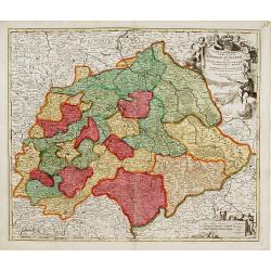
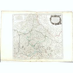
Partie Septentrionale de la Souabe [and] Partie Meridionale de la Souabe. (2 maps)
Pair of maps forms a large, detailed view of Swabia, one of the ten circles of the Holy Roman Empire and containing some of the historically most interesting and cultural...
- $250 / ≈ €213
Date: Amsterdam c. 1745
Cercle de la Basse Saxe, divisée par ses Principautés.
Small detailed map of the northern part of Germany. From Atlas Portatif Universel, by Robert de Vaugondy.Unrecorded state with erased date. Page 22 outside border top rig...
- $50 / ≈ €43
Date: Paris, later than 1749
Partie Sept.le du Cercle de la Haute Saxe divisé par ses Principautés.
Small detailed map of the northeastern part of Germany, with Berlin at the bottom. Including part of Poland. From Atlas Portatif Universel, by Robert de Vaugondy.Unrecord...
- $75 / ≈ €64
Date: Paris, later than 1749
Principatus Halberstadiensis, abbat : Quedlinburgens cum Comitatu Wernigerodano, ad hodiernum verum statum ex acta prodiit ex officina geogr. . .
Detailed map showing principality Halberstadt, Abtei Quedlinburg and the county Wernigerode. Including the towns of Osterwieck, Stollberg, Aschersleben and Oschersleben.
Date: Augsburg, 1750
Dynastiae Comitat. Schoenburgici Penig, Remissa, Rochsburg, Wechselburg In Clientela Elect: Saxon Glaucha, Hartenstein, Lichtenststein, Walkenburg. . .
A very uncommon and superbly decorative map of Lower Saxony, the region southwest of Dresden. Including the towns of Rochlitz, Geringswalde, Mittweida, Frankenberg, Chemn...
Date: Augsburg, 1750
Electoratus saxonici praefecturae annaburgensis pretzschens torgaviensis schweinicensis. . .
Highly detailed map showing the regions of Annaburg, Pretzsch, Schweinitz in Sachsen-Anhalt, Torgau in Sachen and Mühlberg an der Elbe in Brandenburg. In the center of t...
Date: Augsburg, 1750
Cercle de Franconie . . .
Finely and crisply engraved map of part of Germany. Map by Giles Didier Robert De Vaugondy with erased title cartouche. Ornamental title cartouche in the upper part of ma...
- $50 / ≈ €43
Date: Paris, 1752
Le Marquisat et Electorat de Branderbourg.
Fine map of Brandenburg, with decorative title cartouche. George Louis Le Rouge was active from 1740- till 1780 as a publisher, and was appointed engineer for the King of...
- $30 / ≈ €26
Date: Paris 1756
Cercle de Basse Saxe.
Fine map of Lower Saxony, with decorative title cartouche. With manuscript notes in left and right margins giving some historical information about the region. George Lou...
- $50 / ≈ €43
Date: Paris, 1756
Cercle de Westphalie.
Fine map of North Rhine-Westphalia. George Louis Le Rouge was active from 1740 till 1780 as a publisher, and was appointed engineer for the King of France. From his Atlas...
- $30 / ≈ €26
Date: Paris 1756
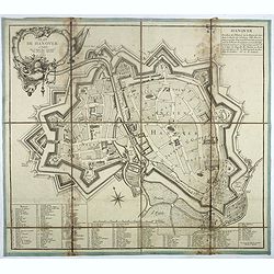
Plan de Hanover.
Town-plan of Hanover, with the new town of St Aegidien built in 1747. Decorated with a title cartouche and accompanied by a numbered key (1-79) of the main streets and bu...
- $200 / ≈ €170
Date: Paris, 1757
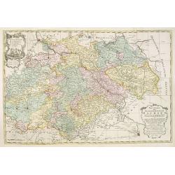
Neue Karte des Kuhrfürstenthums Sachsen. . .
Scarce road map, first published by Peter Schenk II (1698-1775) in his "Neuen Sächsischen Atlas". It is based on a map already created and 1732 and improved in...
- $750 / ≈ €638
Date: Amsterdam, 1758
Partie septentrionale du cercle de Haute Saxe [...] Brandebourg.
Finely and crisply engraved map of north eastern part of Germany, including part of Poland. With inset map of Brandenburg. Map by Giles Didier Robert De Vaugondy with era...
Date: Paris, c. 1760
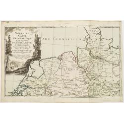
Nouvelle carte géographique des postes et autres routes d'Allemagne. . .
Map showing the northern provinces in Germany and part of the Netherlands. Decorative title cartouche in the upper left corner. A so-called post road maps.
- $80 / ≈ €68
Date: Paris, 1766
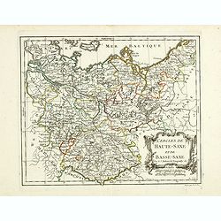
Cercles de Haute-Saxe et de Basse-Saxe.
Early edition of this fine map of the duchies of Saxony (upper & lower), including part of present-day Poland. Published in "Atlas Portatif de Vaugondy".Cha...
- $75 / ≈ €64
Date: Paris, ca.1770
Carte de L'Empire D'Alemagne avec les Etats de Bohême..
Attractive map centered on the southwestern part of Germany, including Switzerland, Luxembourg and part of Austria.Decorative title cartouche with wine grapes, musical in...
Date: Paris ca 1783
Cercle de Haute Saxe.
Finely and crisply engraved map of Germany, centered on Leipzig .Venetian edition of Giles Didier Robert De Vaugondy's map from Atlas Universel printed in 1776-84.Ornamen...
Date: Venice, 1776 - 1784
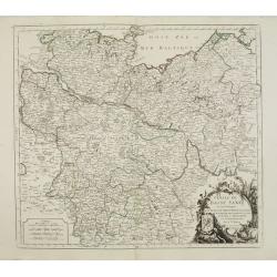
Cercle de Basse Saxe où sont distingués les états de ... et des évêchés d'Hildesheim et d'Halberstadt par le Sr. Robert.
Finely and crisply engraved map of northern part of Germany, including the river Elbe, with Hamburg until Potsdam. In the upper right the Baltic coast including Wismar, R...
- $150 / ≈ €128
Date: Venice, 1776 - 1784
Carte des Cercle du Haut et du Bas Rhin.. avec leurs enclaves.
Finely and crisply engraved map of Germany showing the river Rhine, including Duisburg, Spire, Mannheim, etc.With ornamental title cartouche and noteworthy topographical ...
- $75 / ≈ €64
Date: Venice, 1776 - 1784
Cercle de Franconie.. Reineck d' Erpach.
Finely and crisply engraved map, centered on Schweinfurt, Bamberg and Nuremberg.With ornamental title cartouche and noteworthy topographical detail.The map was prepared b...
- $100 / ≈ €85
Date: Venice, 1776 - 1784
Le cercle De Baviere.. et la prevoté de Berchtolsgaden.
Finely and crisply engraved map centered on Regensburg, including some great skiing resort areas of Austria and part of Germany, centered on Passau, Ingollstat, Salzburg....
- $100 / ≈ €85
Date: Venice, 1776 - 1784
Cercle de Haute Saxe.
Finely and crisply engraved map of Germany, centered on Leipzig. From Atlas Universel printed in 1776-84.With ornamental title cartouche and noteworthy topographical deta...
- $75 / ≈ €64
Date: Venice, 1776 - 1784
Cercle de Basse Saxe où sont distingués les états de ... et des évêchés d'Hildesheim et d'Halberstadt par le Sr. Robert.
Finely and crisply engraved map of northern part of Germany, including the river Elbe, with Hamburg until Potsdam. In the upper right the Baltic coast including Wismar, R...
- $100 / ≈ €85
Date: Venice, 1776 - 1784
Cercle de Westphalie divisé en tous ses Etats et Souverainetés.
Finely and crisply engraved map of central Germany, including the river Rhine from Deventer till Bonn, with Dusseldorf. In upper left , inset of the area of Emden until O...
- $100 / ≈ €85
Date: Venice, 1776 - 1784
Cercle de Westphalie, divisé suivant ses différentes Principautés.
Small detailed map of the north western part of Germany, centred on Münster. From Atlas Portatif Universel, by Robert de Vaugondy.Edited by : "Au dépôt de Géogra...
- $30 / ≈ €26
Date: Paris, 1799
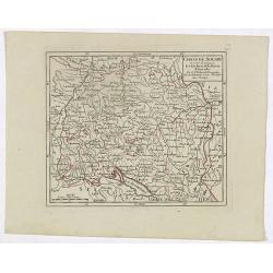
Cercle de Souabe où sont distingués les Enclaves de la Maison d'Autriche.
Small detailed map showing the state Baden-Württemberg, part of Bavaria and part of Austria.From Atlas Portatif Universel, by Robert de Vaugondy. Edited by : "Au d�...
- $70 / ≈ €60
Date: Paris, 1799
VII. Cours du Rhin où sont les environs de Philisbourg, Spire Landaw &c.
Small detailed map illustrating the stretch of the Rhine which flows between Germersheim and Speyer.From Atlas Portatif Universel, by Robert de Vaugondy. Edited by : &quo...
- $25 / ≈ €21
Date: Paris, 1799
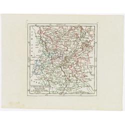
Cercle des quatre Electeurs.
Small detailed map of part of western Germany, centered on Frankfurt. From Atlas Portatif Universel, by Robert de Vaugondy.Edited by : "Au dépôt de Géographie, Ru...
Date: Paris, 1799
Cercle de Baviere où se trouvent le Palatinat de Baviere et l'Archev. De Saltzbourg.
Small detailed map of the southeastern part of Bavaria, including part of Austria. From Atlas Portatif Universel, by Robert de Vaugondy.Edited by : "Au dépôt de G�...
Date: Paris, 1799
Westphalen.
Nice small map of Westphalia in Germany by Johannes Walch in his rare Allgemeiner Atlas Nach den bewährsten Hülfsmitteln und astronomischen Ortsbestimungen…, edition ...
- $50 / ≈ €43
Date: Augsburg, 1812
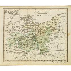
Brandenburg und Pommern.
Nice small map of Brandenburg and Pommeren, centered on Berlin by Johannes Walch in his rare Allgemeiner Atlas Nach den bewährsten Hülfsmitteln und astronomischen Ortsb...
- $75 / ≈ €64
Date: Augsburg, 1812
[No tittle] Partie de la Prusse.
Detailed map of the south of Baltic Sea. With a paper printed label of the Paris map seller Jean Goujon who was active from 1793-1826. The label carries the address of Ru...
- $90 / ≈ €77
Date: Paris, c. 1820
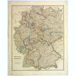
Western Germany.
A lovely, large steel engraved map of Western Germany. Some of the states engraved are: Holstein, Hannover, Mecklenburg, Saxony, Bavaria, Württemberg and Nassau. An extr...
Date: London, 1839
Le Vie Ferrate e le Strade Postali della Germania centrale e meridionale . . .
Uncommon map of Germany and part of France and Switzerland prepared by Francesco Costantino Marmocchi. Above the map "Geografia Commerciale". From "Il Glob...
- $25 / ≈ €21
Date: Genova, Paolo Rivara fu Giacomo, 1858
Le Vie Ferrate e le Strade Postali della Germania orientale . . .
Uncommon map of Germany and part of Poland, Hungary and Italy prepared by Francesco Costantino Marmocchi. Above the map "Geografia Commerciale". From "Il G...
- $25 / ≈ €21
Date: Genova, Paolo Rivara fu Giacomo, 1858
Provincia ecclesiastica di Colonia nella Prussia (Tav LXXXI)
This large-format south Germany Cologne map is finely engraved and beautifully colored and was prepared by Girolamo Petri, a lawyer who served as a senior official within...
- $250 / ≈ €213
Date: Rome, 1858
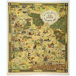
US ZONE. Bavaria, Hesse, Wurtemberg, Baden.
An unusual decorative pictorial map, from the years immediately following World War II, depicting the American Zone of Occupation in southern Germany. It portrays rural ...
Date: Munich, 1940
















![Partie Septentrionale de la Souabe [and] Partie Meridionale de la Souabe. (2 maps)](/uploads/cache/21468-250x250.jpg)






![Partie septentrionale du cercle de Haute Saxe [...] Brandebourg.](/uploads/cache/33211-250x250.jpg)









![[No tittle] Partie de la Prusse.](/uploads/cache/30632-250x250.jpg)
